Keep in mind whilst looking at the following photographs that this drainage channel has been altered, restricted and not maintained since 1930's (most probably). When I was young and can still remember about the early 1950s this creek had a flood gates. They were on the Bulimba Creek side of what is now called Gosport Street to keep tidal salt water from entering the fresh water wetlands it was intended to drain.
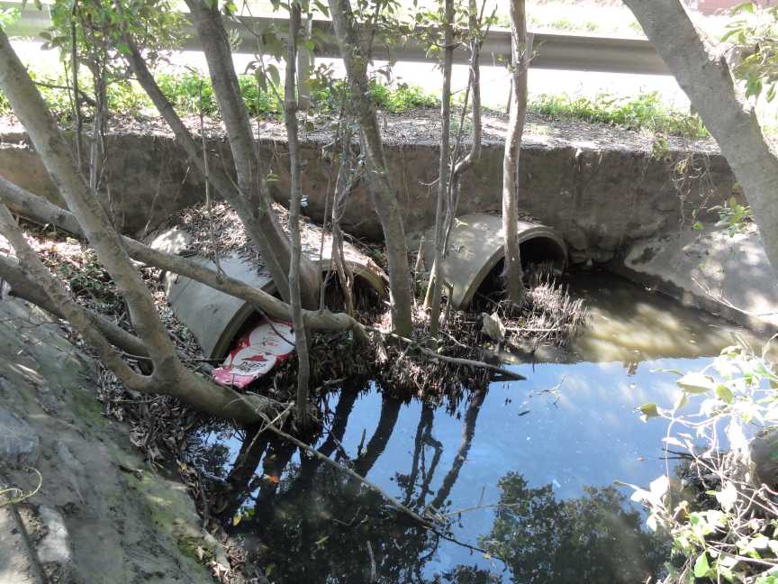
This rail line had a wooden bridge structure at this drainage point which has been replaced with concrete culverts most probably when the dual gauge rail line was built. The flow past the rail line is now massively reduced.
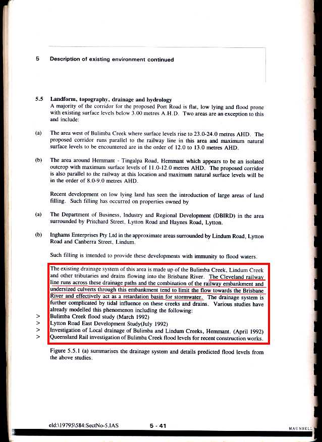
This rail line changed the natural flow capacity of Bulimba Creek as did local roads and the upgrade of Lytton Road near 50 years ago. Since that time massive amounts of fill have been placed downstream of the rail line for industrial development and the original flood plain has disappeared beneath buildings. Apparently no drainage channels were resumed by Brisbane City Council or State Government to allow for ongoing maintenance requirements as the upstream catchment is overdeveloped.
More and more up stream catchment development is being carried out yet no increase or maintenance of downstream drainage is carried out by QRail, Queensland Transport / Main Roads & local council.
Queensland Rail is required by LAW to maintain drainage under its rail lines as to not increase upstream flooding.
What Act in 1995 did the Queensland's Parliament Pass about QRail responsibilities for drainage?
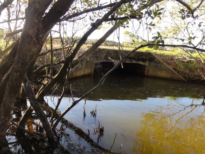
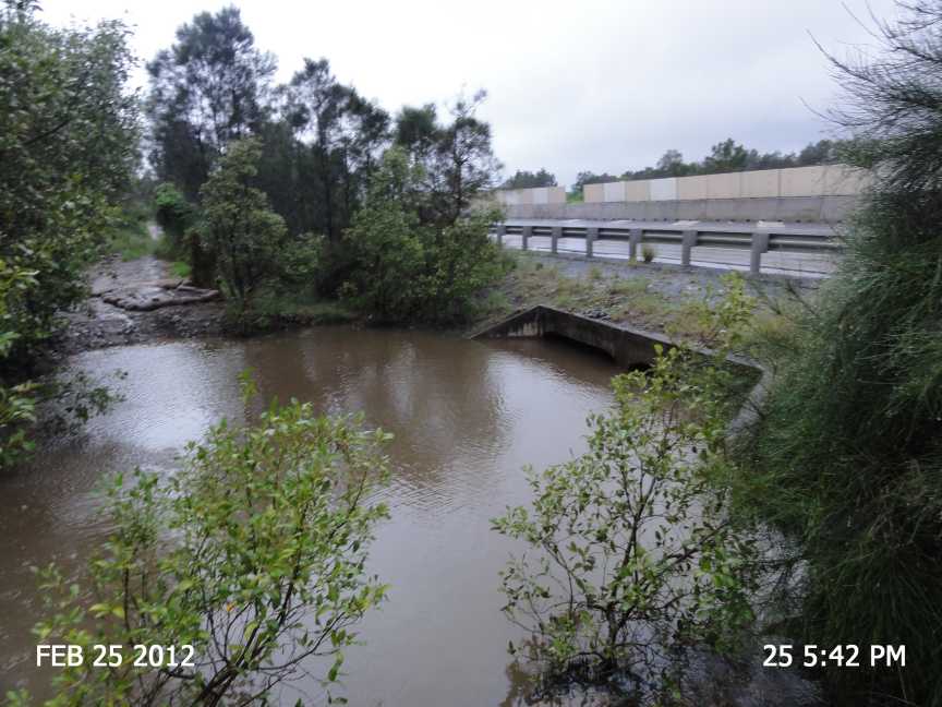
This photo is the southern side of rail line east of Hemmant Railway Station
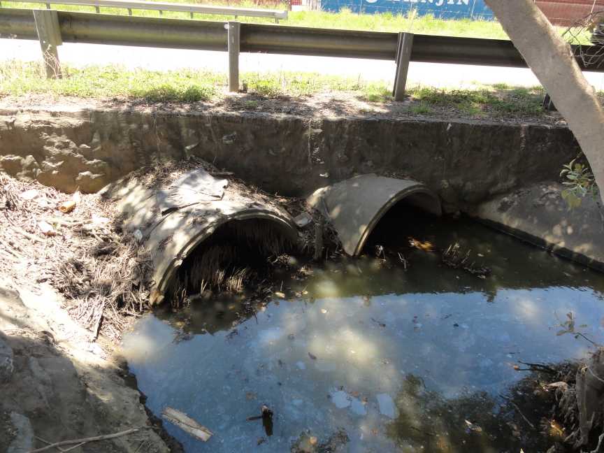
A Brisbane City Council Report suggest that this culvert need to be upgraded
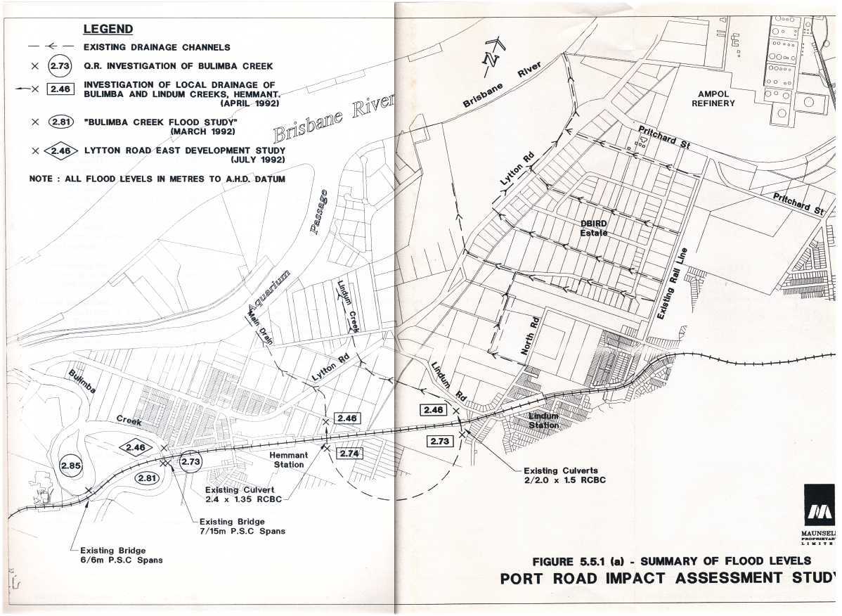
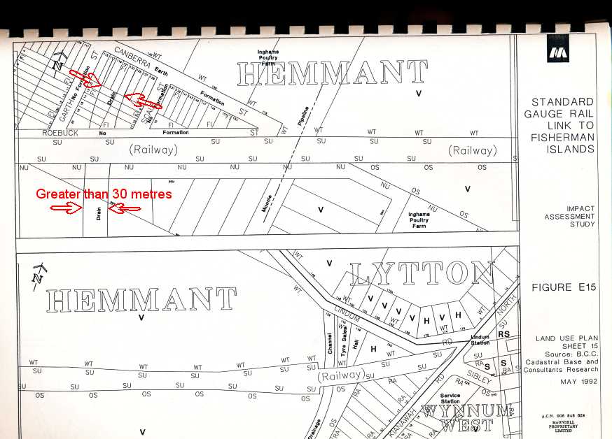
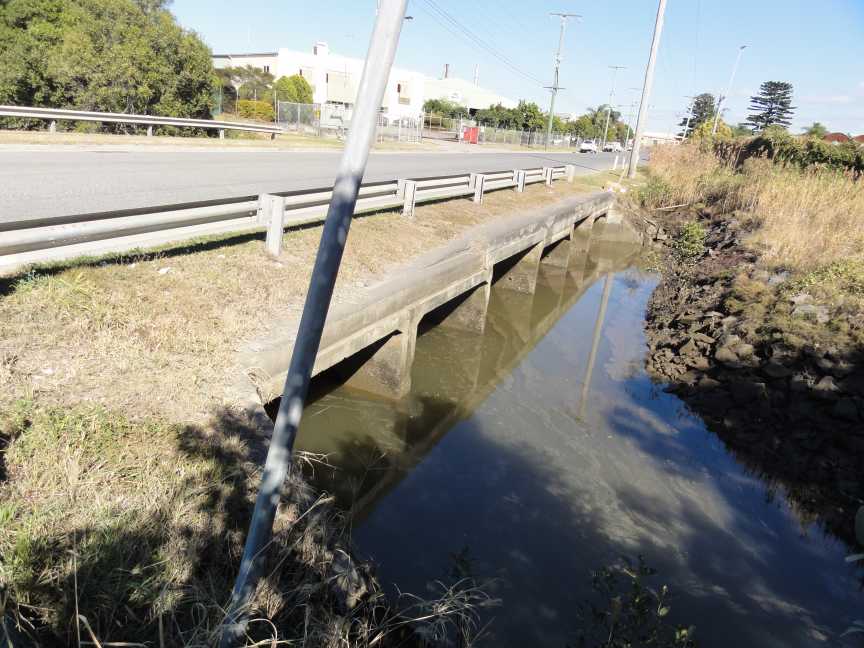
Port Road Culvert near Canberra Street Hemmant (Eastern End)
3 February 2012
3 February 2012
How does this storm water/flood water flow to Bulimba Creek?
It need to pass through a mangrove area between the Port Road and Canberra Street where there is a one meter pipe through under Canberra Street.
But wait the mangrove area is silted up and owned by QUEENSLAND TRANSPORT.
Just how silted up?
On the day before the King Tide on 11 January 2013 I made a video of the oncoming tide at what should have been the peak of the tide at 9:45 am.
The incoming tide was just a little more that trickling into this depression adjacient to the Port Road box culverts.
Press to view the video of 36 seconds at 1.7 megabytes in size.
Brisbane City Council Report
Australia Trade Coast South
Infrastructure Contributions
Planning Scheme Policy 2007 in part:
"The ATC South area is adjacent to the Brisbane River
and a number of waterway corridors.
Most precincts drain directly to the Brisbane River, Bulimba Creek or access
those
waterways via private drainage channels.
The exception to this network is in the Hemmant Precinct where many properties
rely on a
public trunk drainage system to convey stormwater to the River.
Three public stormwater channels provide drainage relief in
the Hemmant Precinct:
.. Main Drain (Hemmant Creek)
.. Mayne-Nickless Drain (Lindum Creek)
.. Iona Drain
These drains are identified in Map 5.
The structure and capacity of these drains varies. Between
the railway line and Lytton Road
the drains are substantially concrete lined. Between Lytton Rd and Aquarium
Passage the
channels have been excavated on an incremental basis and local erosion and choke
points
are present. The drains between the railway and Aquarium Passage are capable
of
conveying existing Q100 flood flows."
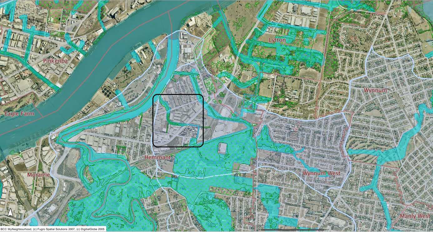
I was under the impression that Hemmant Creek started near the cnr of Manly Road and Kianawah Road South. (Hargraves Road) Manly West.
According to the text above this map below Hemmant Creek is east of Hemmant Station and flows to Bulimba Creek via Lytton Road and Gosport Street.
Also the BCC should note that where their map below says it is Mayne Nickless Catchment is actually Main Drain catchment but it has a restricted flow path to Bulimba Creek.
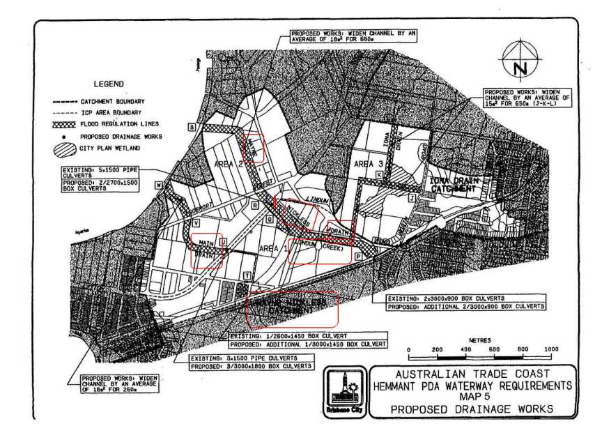
It is obvious that different reports have different names for the same creek or drain.
Obviously the authors never visited the area and other who read the reports have no idea what they are about.
This may explain why this drainage problem has existed for so long.
After reading other BCC reports all of the upstream catchment work is to take place first and the residents in the lower catchment will be last to have any drainage work undertaken.
Upstream housing development first downstream drainage last. Just flood them out. Good one BCC.
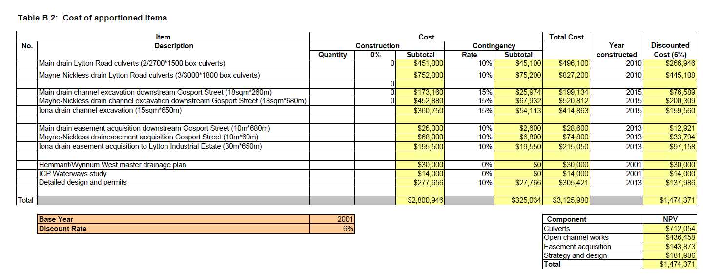
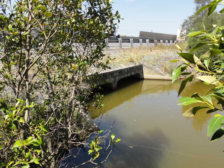
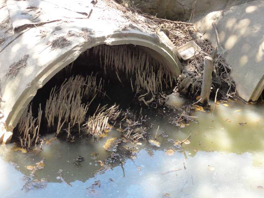
What remains unexplained is the need to upgrade the culverts beneath Lytton Road at Hemmant (near Canberra Street)(The first item in the table above) Why they need to be upgraded and not the drainage channel around the Container park and the undersized culvert (only 1.05m diameter) beneath Canberra Street on Queensland Transport Land. Not to forget the undersized box culvert under the rail line.
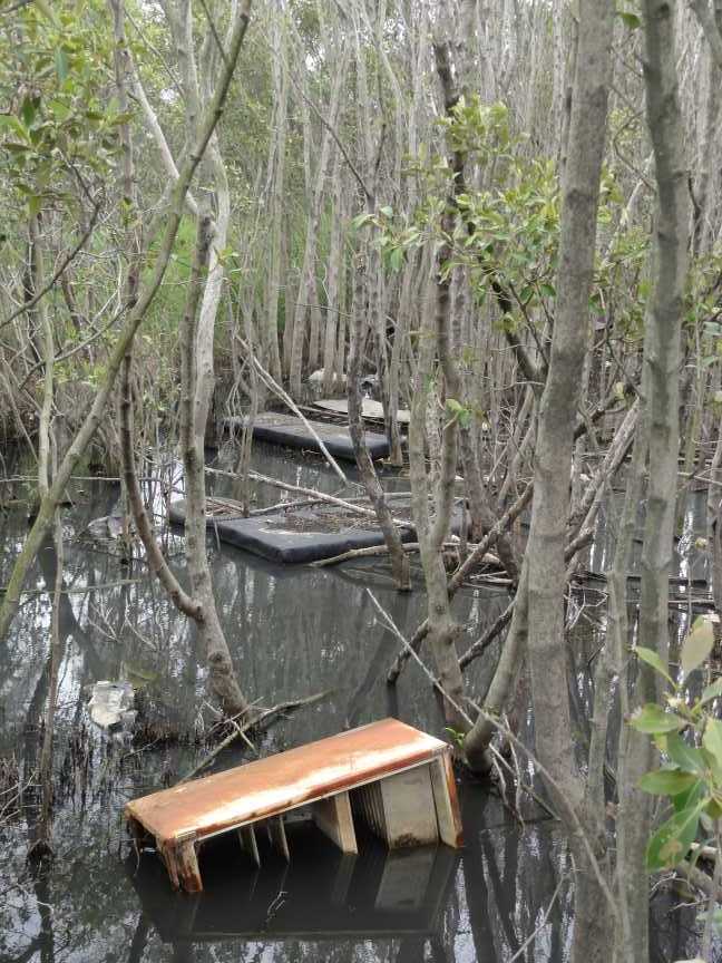
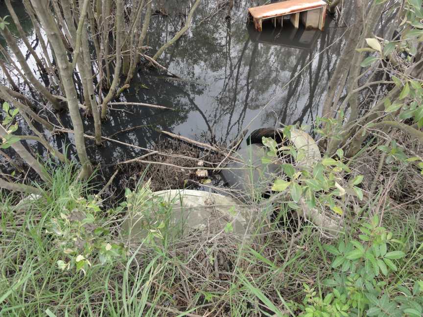
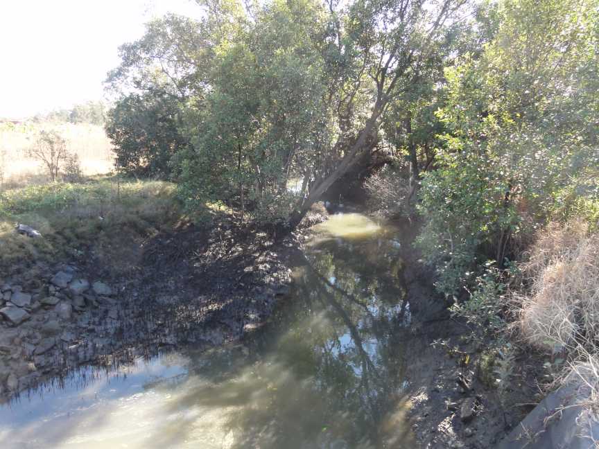
Mangrove wetland up stream of Canberra Street looking towards Port Motorway TMR land
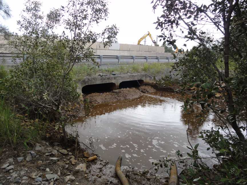
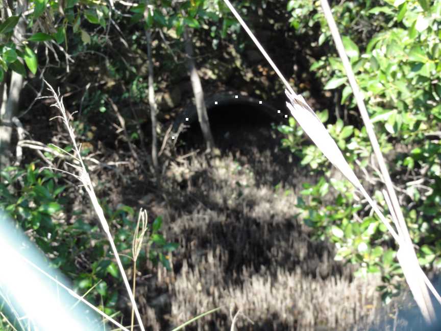
Rubbish and mangroves at entrance to single drain pipe under Canberra Street Hemmant
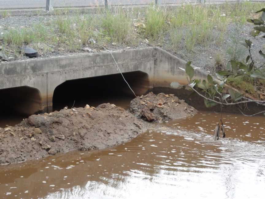
After reading the BCC report above this 1 metre pipe is capable of carrying Q100 flood flows?????????
The alternate flow path towards Lindum Creek has a 1.2 m high road across the entire drainage channel with only one 45 cm and one 30 cm pipes beneath the road.
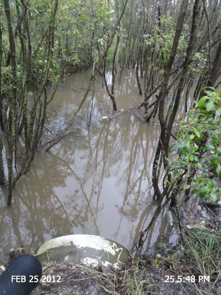
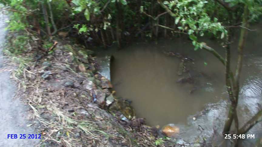
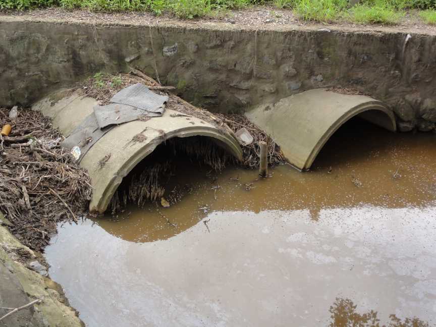
Photo 25 February 2012 during rain periods.
This pipe culvert is approximately 1 metre in diameter.
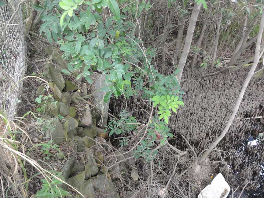
Canberra St (eastern end) with limited drainage beneath and that is half blocked with silt and mangroves TMR owned land.
Under Canberra Street (east end) downstream side
Another view of the culvert downstream of Canberra St as above.
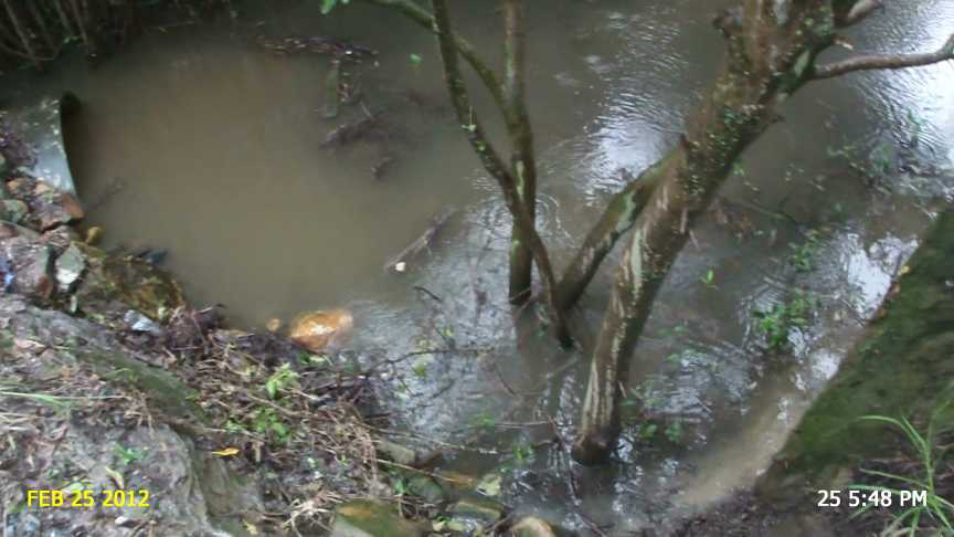
Note the mangroves and silt inside of this single drainage pipe.
East side of Lytton Road water flows towards camera position north of Canberra Street
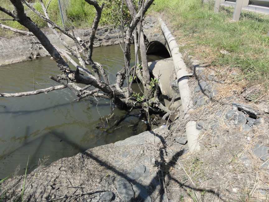
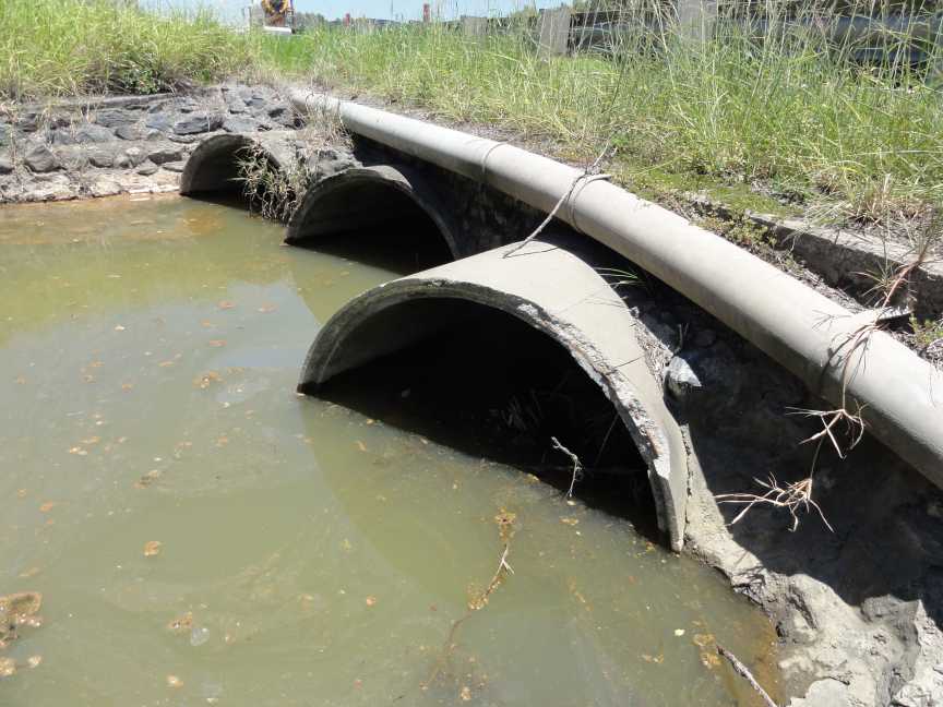
Culvert under Lytton Road upstream side
Brisbane City Council Documents show that the Brisbane City Council wants these pipes (3 by 1.5 metres pipe culverts) below upgraded to 3 by 3 metre by 1.800 metre box culverts.
4 Jan 1012 Mangrove Tree removed root ball still in pipe in September 2012.
Culvert under Lytton Road downstream side
.jpg)
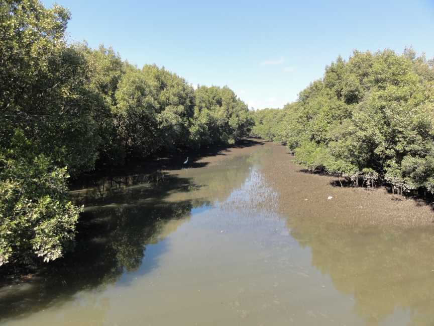
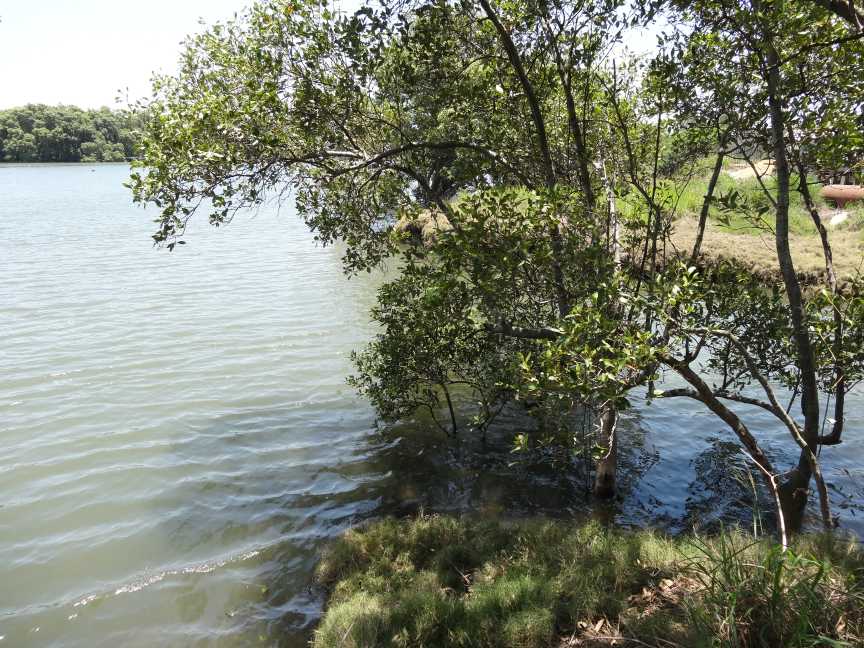
Looking upstream from Gosport Street Hemmant
Culverts under Lytton Road Hemmant downstream side
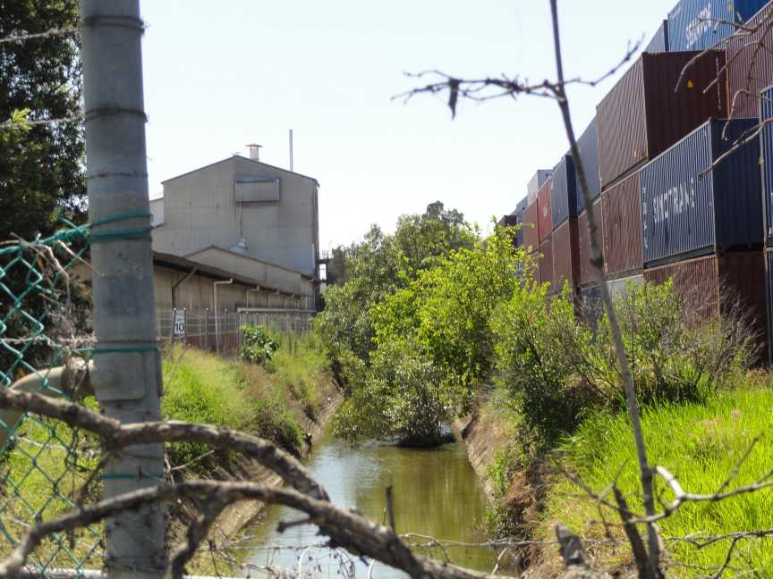
Down stream from culverts under Gosport Street taken from same position as previous photo
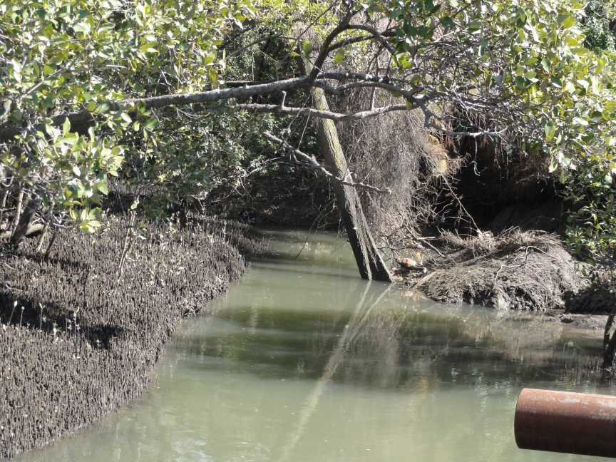
Photo taken from private property about half way between Gosport Street and Aquarium passage August 2011.
Mouth of Main Drain near the Bulimba Creek end of Aquarium Avenue.
This page is maintained by
The Rivermouth Action Group Inc
as a community service.