
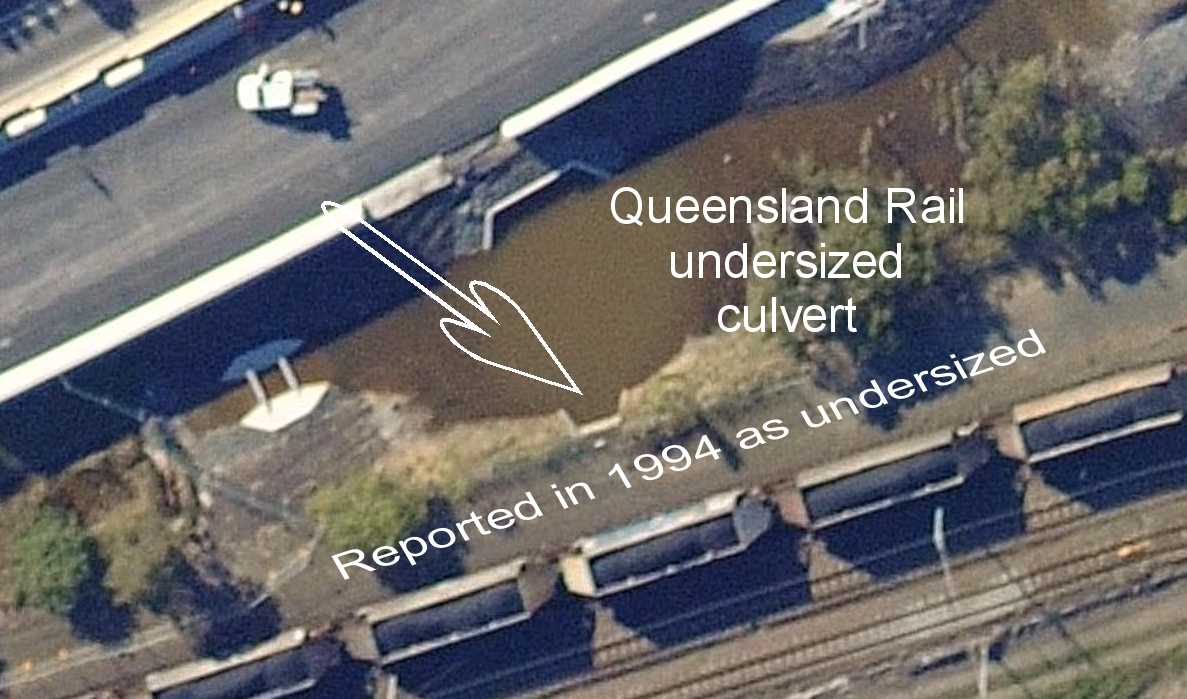
Bulimba Creek, Hemmant Creek and Lindum Creek share the same drainage flood plain south of the Hemmant to Lindum railway line and dispersal of flood waters are then restricted by the undersized Rail Line culverts and Lytton Road with its few undersized culverts and all drainage corridors from the rail line to the Brisbane River and/or Bulimba Creek are undersized, silted up and totally neglected.
"SERVING MANY COMMUNITIES"

"HEMMANT DRAINAGE.
Sir,-The whole countryside at Hemmant and Lindum is under water this morning. The fault lies with the mouths of existing old drains having been filled up by the river dredges with silt pumped on the banks. The population around here have approached the City Council time after time to have this evil remedied. Letters also have been written, and the Progress Association has made efforts, but all of no avail. The situation becomes worse every time it rains, and has reached a point now where some drastic action seems necessary at once.
We are paying higher rates, values have been increased, and there is no doubt about it, we are getting practically no local attention worth mentioning. After all, the local bodies were more competent to deal with local affairs than this unwieldy Greater Brisbane machine which has been set up, and seems to be unworkable, to handle minor affairs, no matter how urgent they are. As drainage is the first principle of health, and we have set up a Health Board, with a mosquito department and other bodies, it would seem that some practical action would be taken on these lines, especially when several approaches have been made to the authorities in that direction.
However, the inactivity of a body set up to look after public health and comfort is amazing. If the Greater, Brisbane scheme is to have public approval and confidence, different lines of action will be absolutely necessary to prove their .worth, and merit their existence. So .far, .the public around here is sadly disappointed with- their efforts and results, and has cause to be. We have no-individual right to act, and w" cannot personally go and remedy the drainage evil, under threat of legal action, and collectively, though many efforts were made, and are still being made, we seem to be also powerless. This state of affairs is very serious. We cannot remedy the evil ourselves, and the body set up to remedy it will not act. We really pay for service, but are refused the service we pay for.
We cannot clear out and leave our places, where we have toiled and spent our money in improvements. The old settlers here had a drainage board. They had drains dug, and floodgates put in, and we, the advanced generation, allowed them to collapse, and we allow further that the Harbour Board can bank up all the possible means of water escape with silt out of the river, and we look on powerless.We see our cultivations flooded, knowing that the neglect of duty of the authorities we set up are responsible for the damage, yet we are seemingly powerless to act. What is wrong here? Someone must rise up and move; some final effort must be made to improve the position. Drainage is the first principle of health and comfort, and it is the council's bounden duty to see to it.
I am, sir, &c.
C. ANTHONY COURT.
Hemmant, April 10.1928"
October 2013
The story is simply that drainage in this area of Brisbane has been neglected for many decades by all levels and departments of the Queensland Government and the Brisbane City Council.
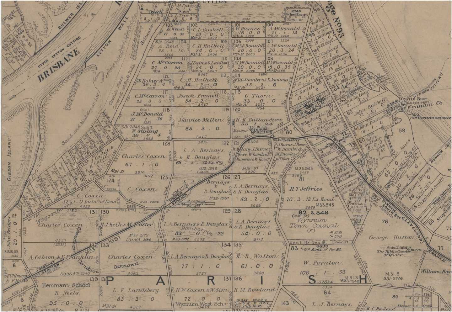
Below is a 1880s map of the Lytton Area of Brisbane showing land owners and original waterways.
Original map from Queensland State Archives.
One of the reasons there is so much inaction on drainage maybe because there are so many reports written about the drainage in the area which are fundamentally flawed.
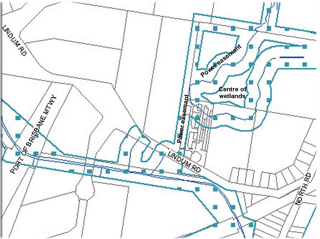
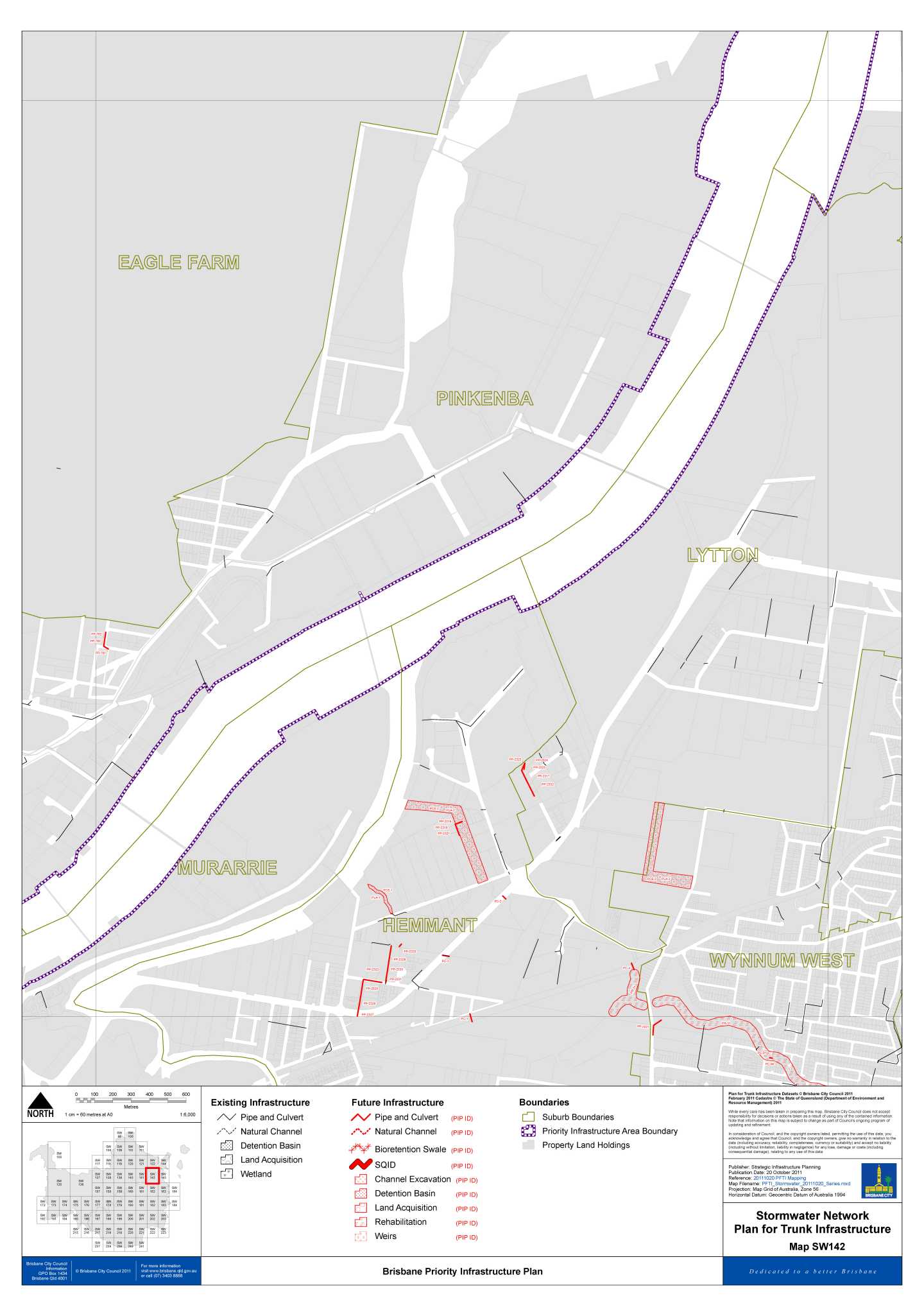
Below is a section of the Revised waterway mapping for the City Plan for Brisbane as at February 2014.
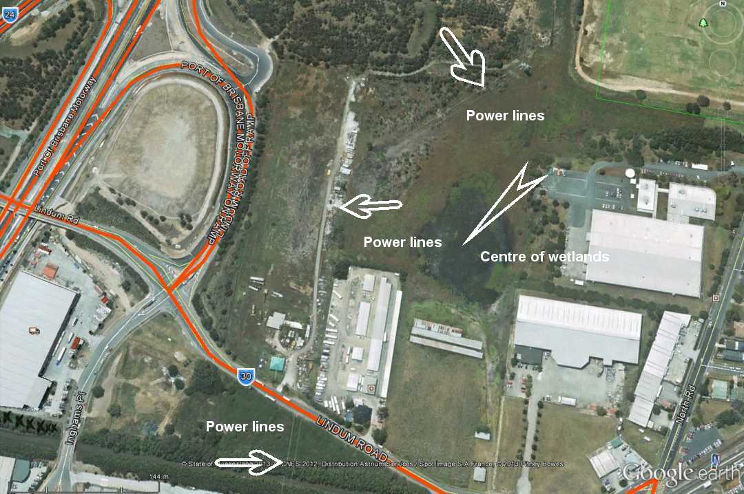
The area highlight in maps below is north of Lindum Road, Lytton.
I have tried to bring this issue to the attention of the City Plan Town Planners but they say that because the submission time has ended no action can be taken.
What you will see if you look closely!
1 The water way shown on the BCC overlay is along a Energex high tension power line.
2 There is a roadway/track beneath the power line to allow all weather access.
3 That the property on the eastern side (118) is filled above the flood level.
4 The wetlands behind 118 and 146 LIndum Road (to the right of the power easement) show no wetland in an area where it is actually the deepest part of the wetland.
.jpg)
.jpg)
This road/track was install without drainage beneath it some 20 years ago along a drainage path by Energex.
Brisbane City Council see this road.track as a drainage line and are not interested in fixing the fault in their overlays.
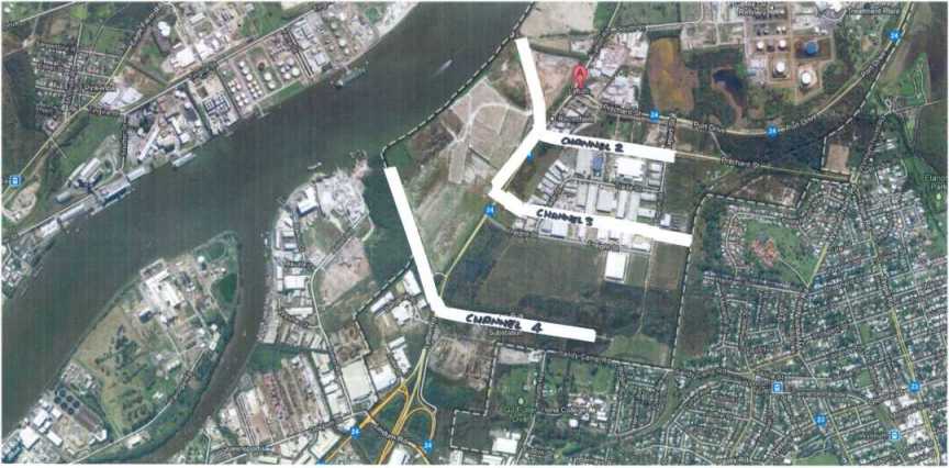
The drainage drawing below was prepared for the Queensland Government after land was compulsory resumed at Lytton for the Port of Brisbane development and an industrial estate.
.jpg)
As you read further you come to understand that this design was never implemented.
One complete drainage channel was never built nor was there ever an upgrade to take into account the reduction of planned drainage capacity to the Brisbane River.
Nor has the built drainage channel (now called Channel 4) at the southern end of the Lytton Industrial Estate been a subject of any regular maintenance or any maintenance at ALL in over 45+ years.
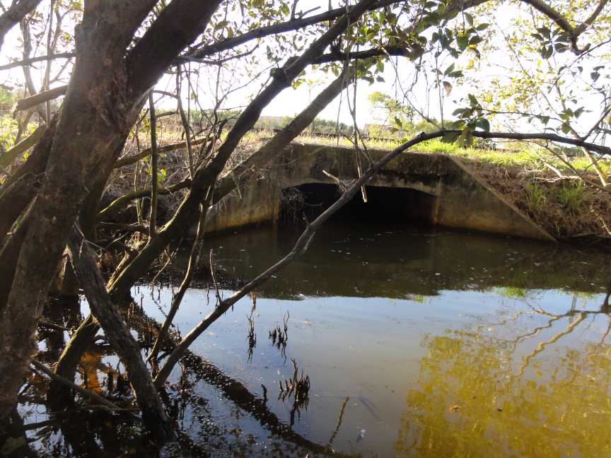
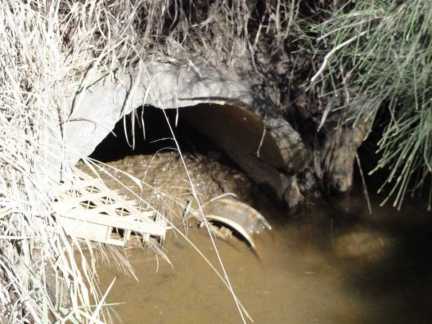
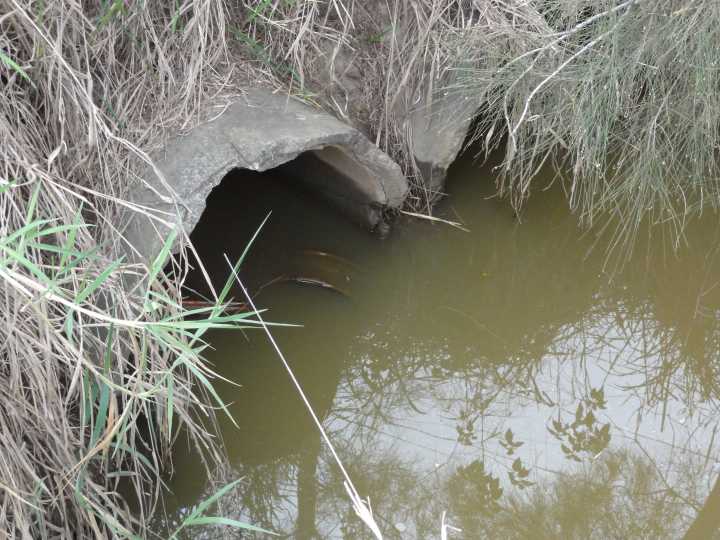
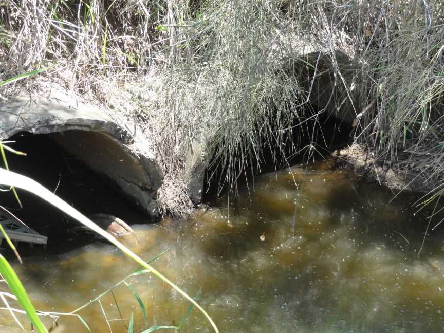
The next two photos (at channel 4) were taken in Brisbane City Council Sandy Camp Park Lytton/Wynnum North/West on 23 October 2013.
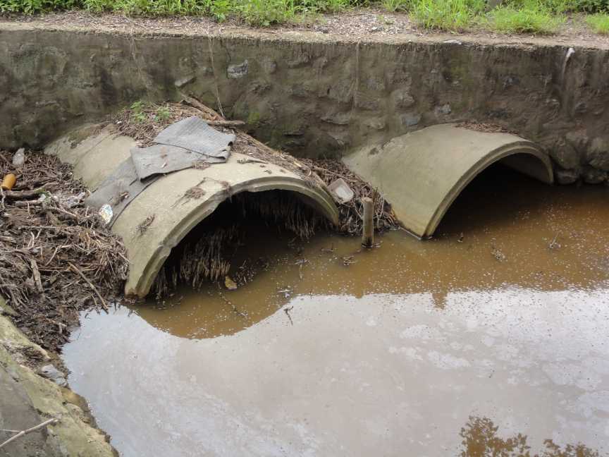
These pipes are to allow storm water run off from the Southern side of the Lytton Industrial Estate to drain into Channel 4
This photograph and the next photo are of the same culverts but from different ends.
When I made a complaint no action was taken or contemplated.
.jpg)
Lindum Creek after work was carried out to clean the sediment out of the creek.
Note how the fill which was placed in the channel to gain access further along Lindum Creek was left remaining in the channel and then washed into Lindum Creek after further rain.
.jpg)
Is this the quality of work the Brisbane City Council should accept from its own workers or Contractors?
Next item from Lord Mayor's October E-Newsletter
I wonder if there has been any money allocated to fix this problem?
Over to you Lord Mayor.
4BC Tuesday 5 February 2013.
I was on talk back radio with Gary Hardgraves. To listen, click on link just below.
The most feared sentence in the English language is:
"We are from the Government and we are here to help you."
Queensland Urban Drainage Manual – volume 1 second edition 2007
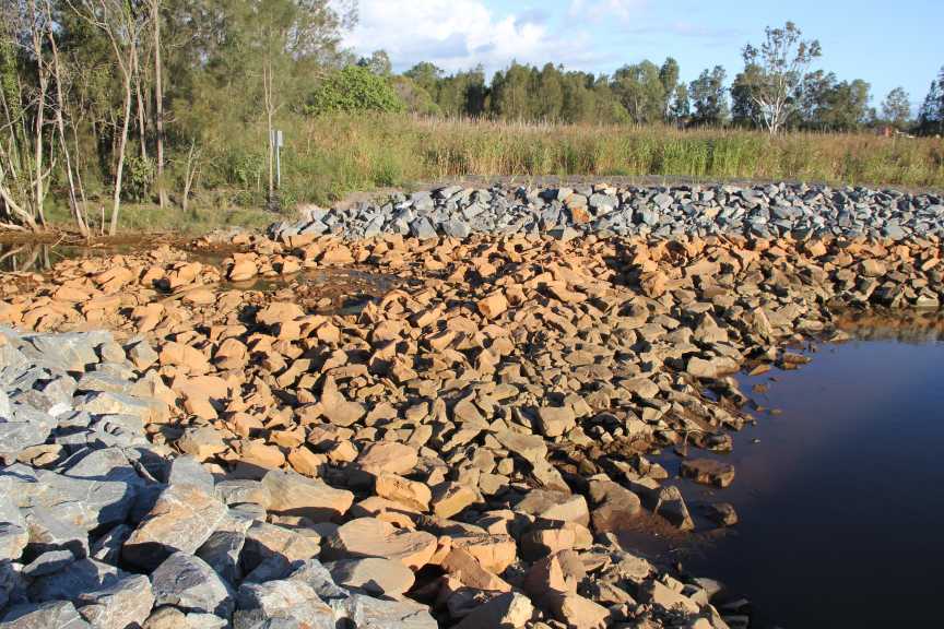
Looking South East
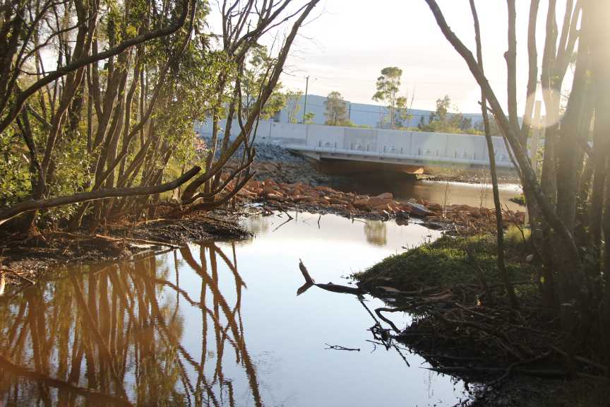
Looking West South West across Port of Brisbane Motorway.
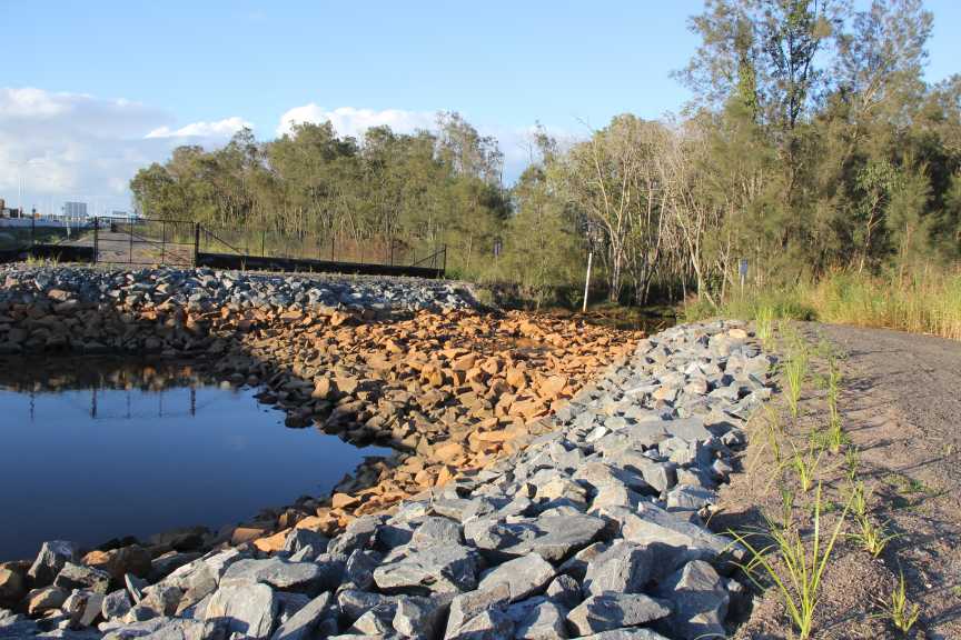
Looking North East
Upstream drainage is not draining and resident have been wondering WHY?
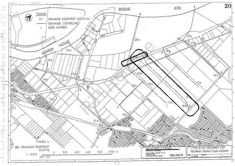
Lytton Road East Development Study 1992 Report. Note the drainage channel proposed highlighted.
This included 4 x 1800 pipe culverts under Lytton Road (never built)
This proposed drainage channel was to be 18 to 19 metres wide.
Was was built? NO!!! 3 X 1200 pipes into a UN-maintained drain and these three outlet pipes are all but fully blocked.
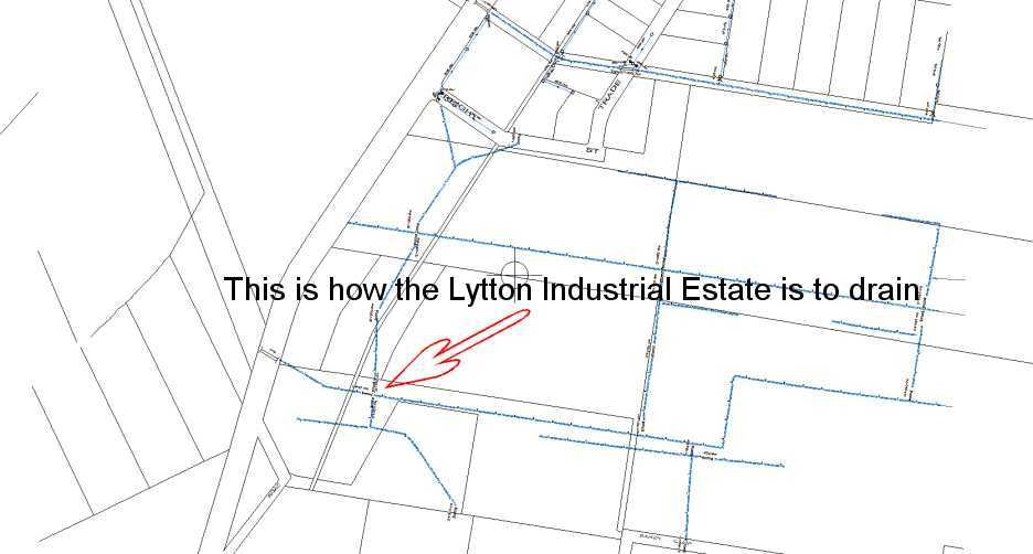
Then Southern Lytton Industrial Park as constructed drainage:
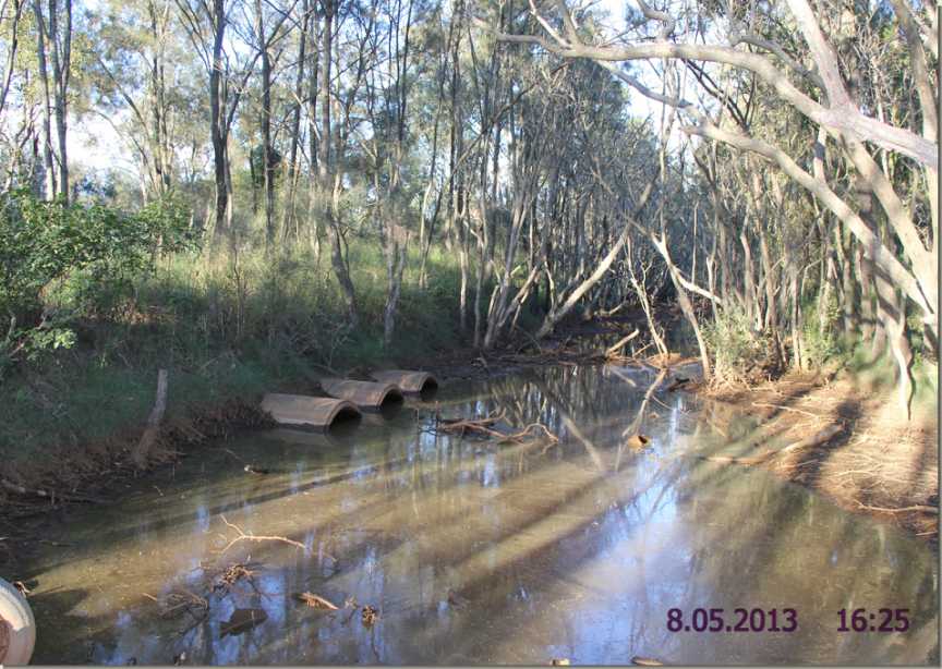
Then note the state of these important drainage culverts below.
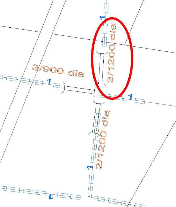
Size of 3 pipes 1.200 metres.
.jpg)
The other end of these pipes.
Then try to flow under/over this causeway/flood gates of only 3 x 1.5m pipes. (40+ years of complaints and no actions).
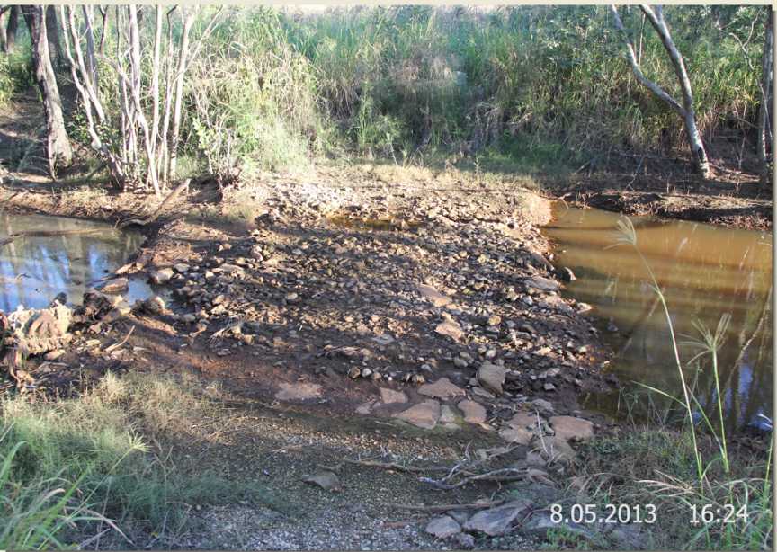
Then over/under tide gate. Three 36 inch pipes, (remain un-maintained)
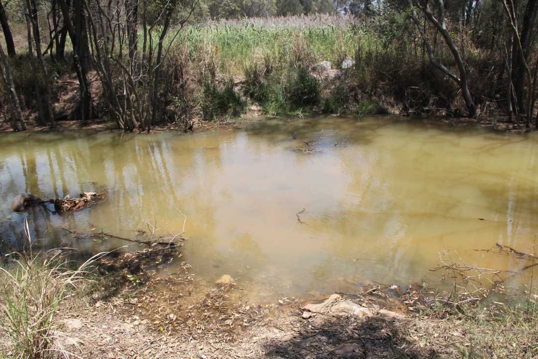
Same Tide Gate as above not restricting tidal flows.
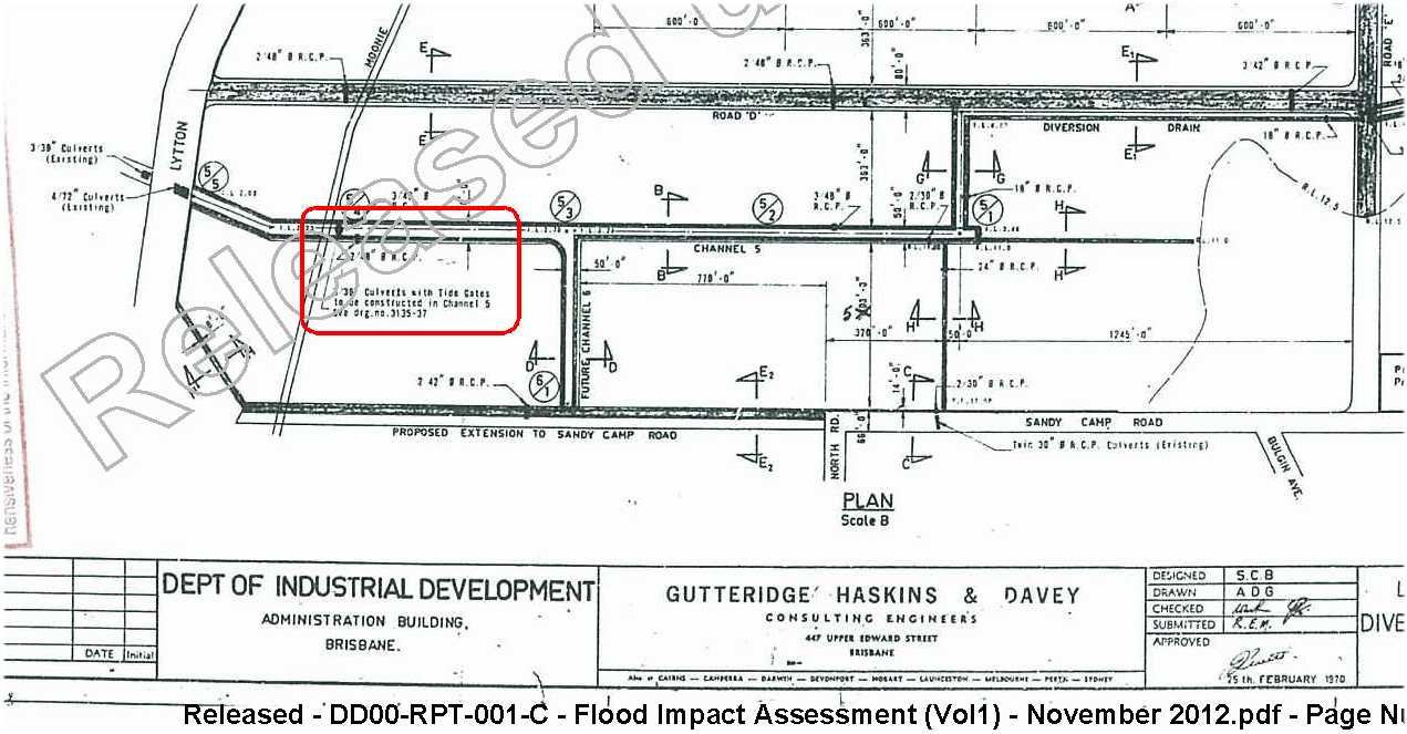
Channel 5 (now named Channel 4 as Channel 4 was never built as designed) Note construct tide gates 3 x 36" culverts.

It becomes quite obvious that the Brisbane City Council and staff are not up to the task they are paid for.
Documents received under Right to Information Requests 2013.
Australia Trade Coast South Hemmant Waterway Study 2001
Lytton Road East Development Study 1992 Pages taken from relating to drainage
Bulimba Creek Catchment Management Plan ca 1999
During 2012 residents along Ragnor Road, Hemmant were served with court approved search warrants and properties searched.
What was the Brisbane City Council Looking For?
Illegal filling!!
One property owner nearby has already spent time in Jail for the fill he had placed on his property.
Why you may ask?
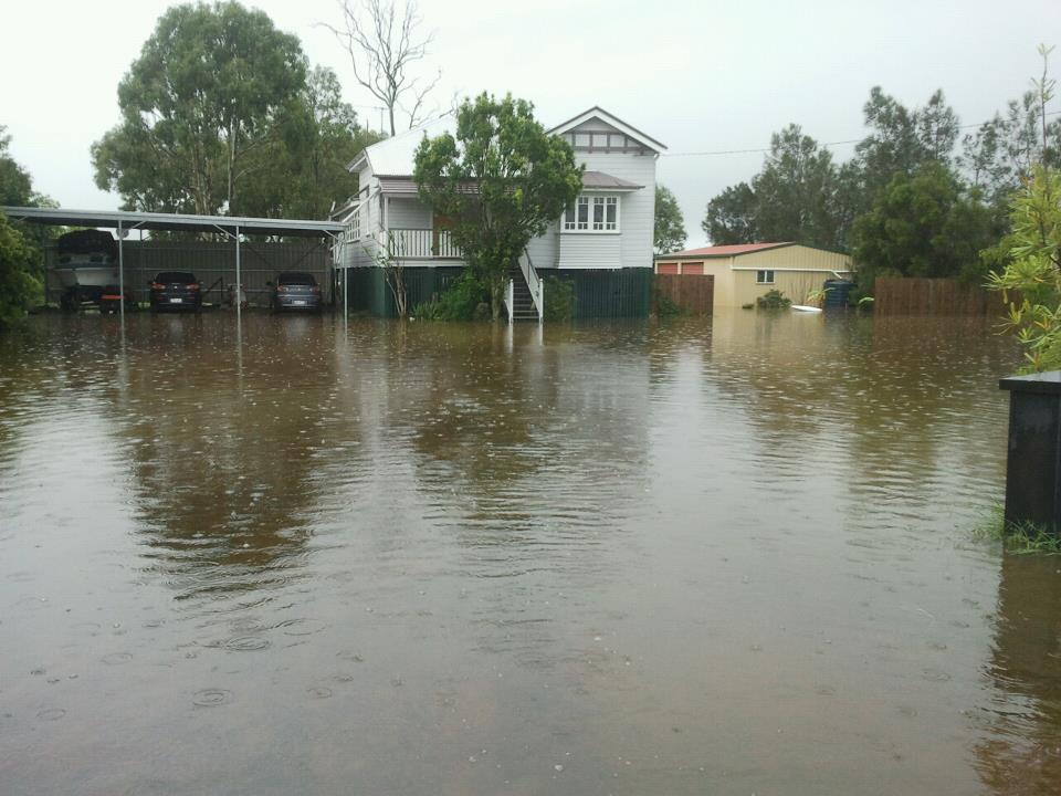
During periods of heavy rain and Bulimba Creek floods, waters simply flow upstream and over or around the Tidal Gate on Hemmant Creek, and floods properties along Ragnor Road Hemmant and other properties such as Foley Road within the Hemmant Flood Plain.
Some land owners have imported fill to keep under their houses dry and/or their driveway usable.
Keep in mind that these properties are just 11 kms from the Brisbane CBD and several do not have town water connected.
Also many have no sewerage connected either and septic tanks and their pumps do not operate well under water.
Their homes are just 2 kms from a major sewerage works on Gibson Island.
Tank water only goes so far when cleaning up after heavy rain.
Why does it flood so much, so often or for so long there?
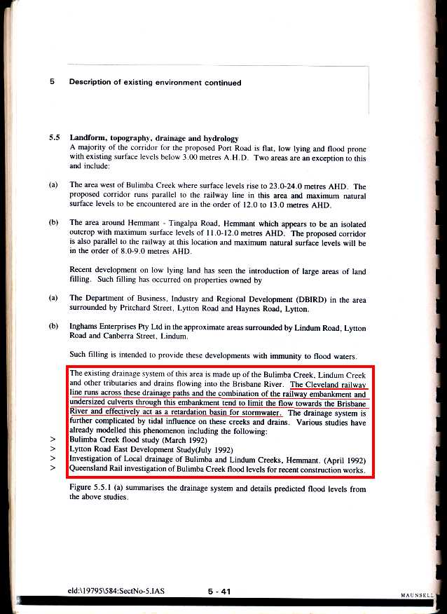
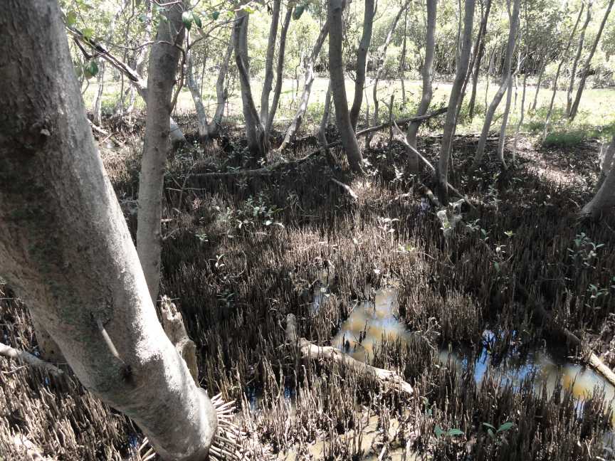
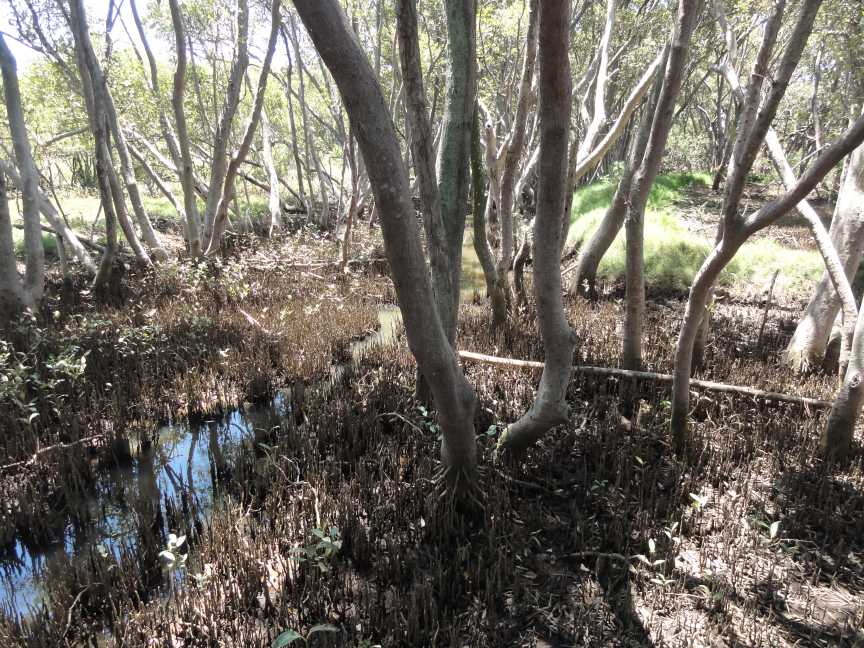
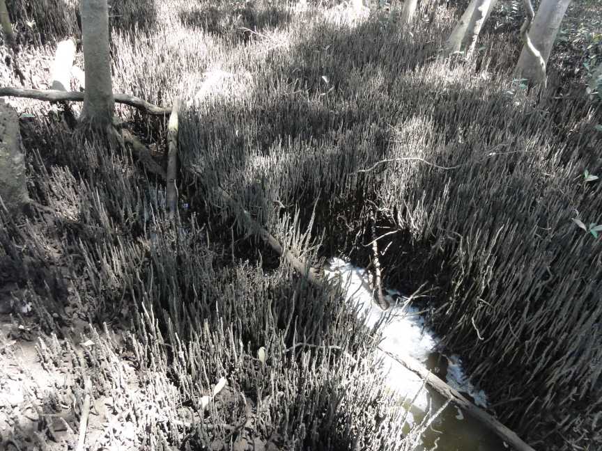
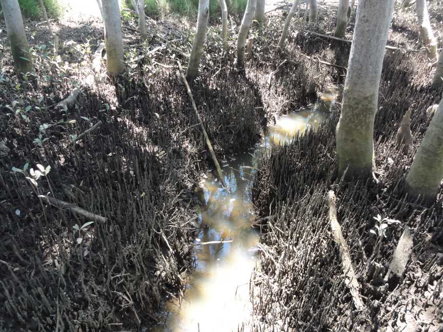
Simply they are in a flood plain (made worse by the Queensland Government Rail Line with undersized culverts. Then Lytton Road, form restrictions due to unmaintained culverts, Gosport Street with undersized culverts which are not maintained and drainage channels which are not maintained.(refer to Connell & Wagner's Bulimba Creek Flood Study and the Lawson and Trelor, "Hemmant Wynnum West Area Master Drainage Investigation and Flood Study.) Check out the BCC flood map below to see the flood water held behind the rail line) and the drainage channels which are meant keep them flood free or reduced flood levels or duration times are either to small or simply full of mangrove roots or silt or fallen trees or the creek banks filled in by or narrowed by industrial development and due to the lack of any maintenance or interest by Queensland Rail, Queensland Department of Transport and Main Roads and Brisbane City Council.
Again the Brisbane City Council has unlimited money for Barrister, Lawyers, law clerks and inspectors, signs etc. to put you in Jail but cannot find any funds for drainage works in over 40 years after several costly flood studies/reports.
.jpg)
Wynnum Road Cannon Hill 4 Feb 2012
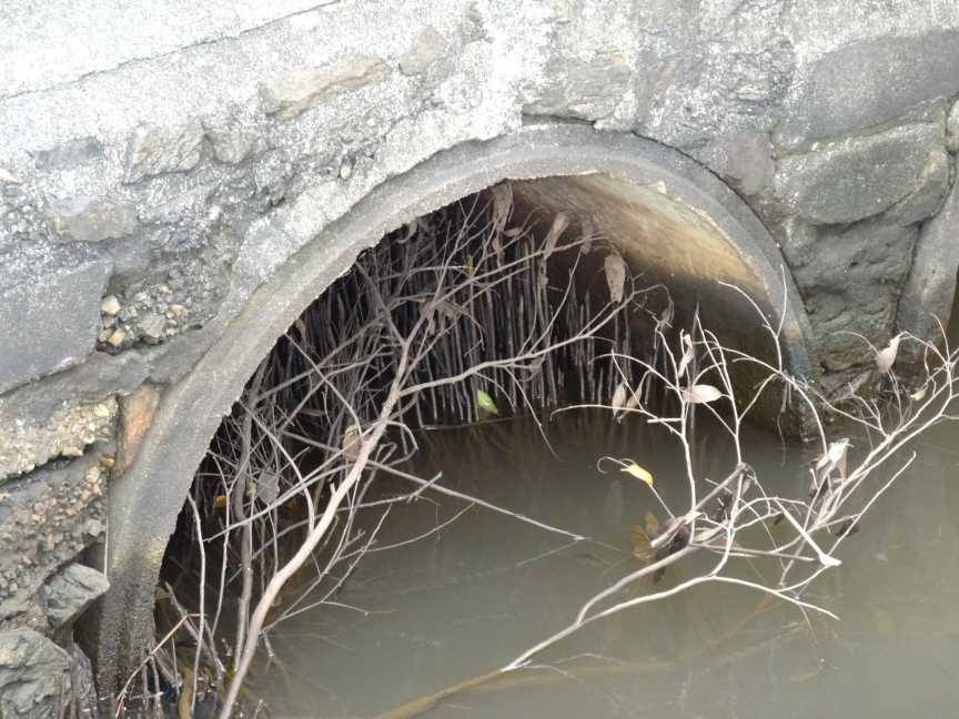
Hemmant Creek 7 April 2012 . At footbridge near Tidal Gate Reported to Brisbane City Council during October 2012.
Just in case the Brisbane City Council is uninformed the tide go out twice a day. (Or tries to)
What are they waiting for the tide to stay out for a week or so????
Following Photo taken 23 October 2013.
12 Months has passed by since a formal complaint to Brisbane City Council, and many follow up phone calls and further reports.
The BCC files obtained under Right to Information showed that my complaint was marked as completed
.jpg)
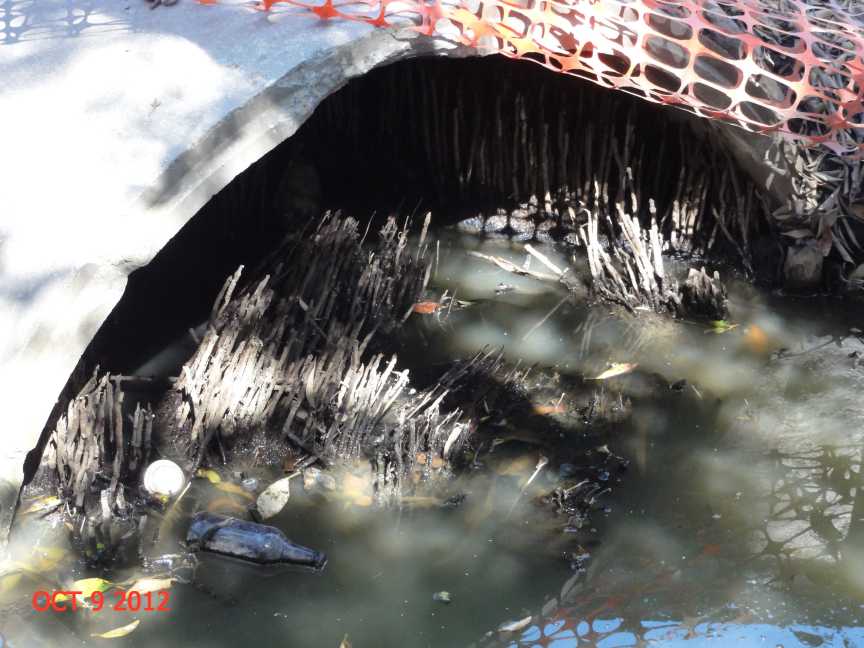
Then after a visit to the BCC Carindale office in October/November and speaking to a Manager the following 2 photos were taken about 6 weeks later.
That's right it has taken over 12 months to clean out two of these culverts which are undersized as well.
.jpg)
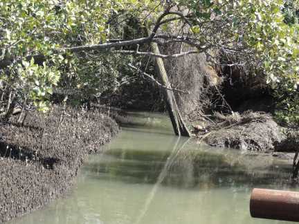
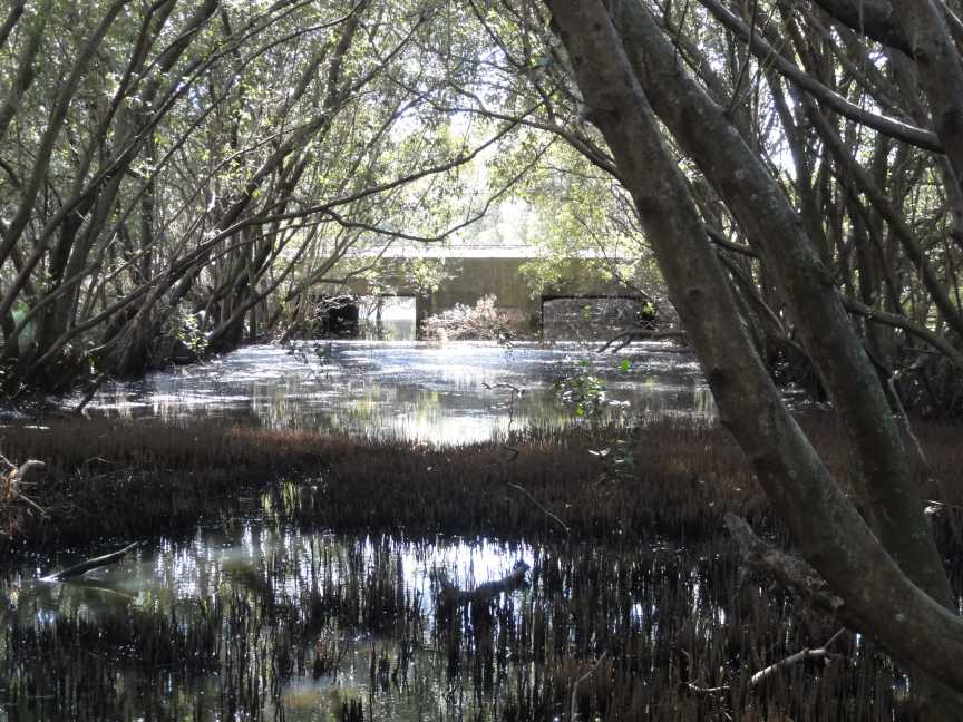
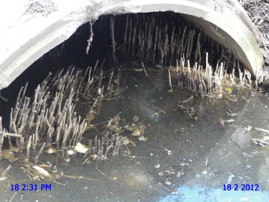
Finally the BCC has cleaned out the mangrove roots from the pipes under the pederterian bridge on Hemmant Creek near Hemmant and Tingalpa Road as below.
Over two years since reported and continued to be complained about.
.jpg)
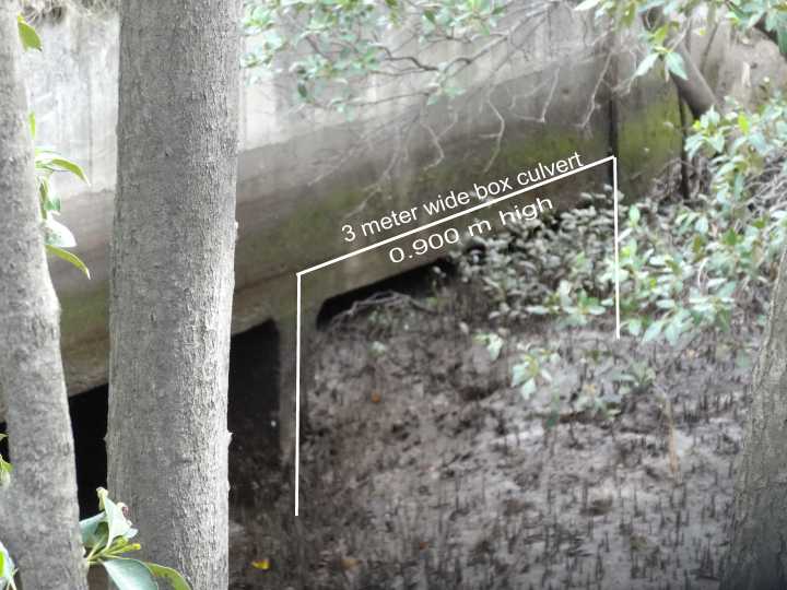
This photo taken 7 April 2013 of Lindum Creek at Gosport Street Hemmant.
Reported to the Brisbane City Council 8 April 2013
4 box culverts and this is the western side culvert on the downstream side.
I found this same culvert in the same condition in 1995.
Photos elsewhere in Website.
Photo below 9 months later. Still no action with the wet season approaching.
.jpg)
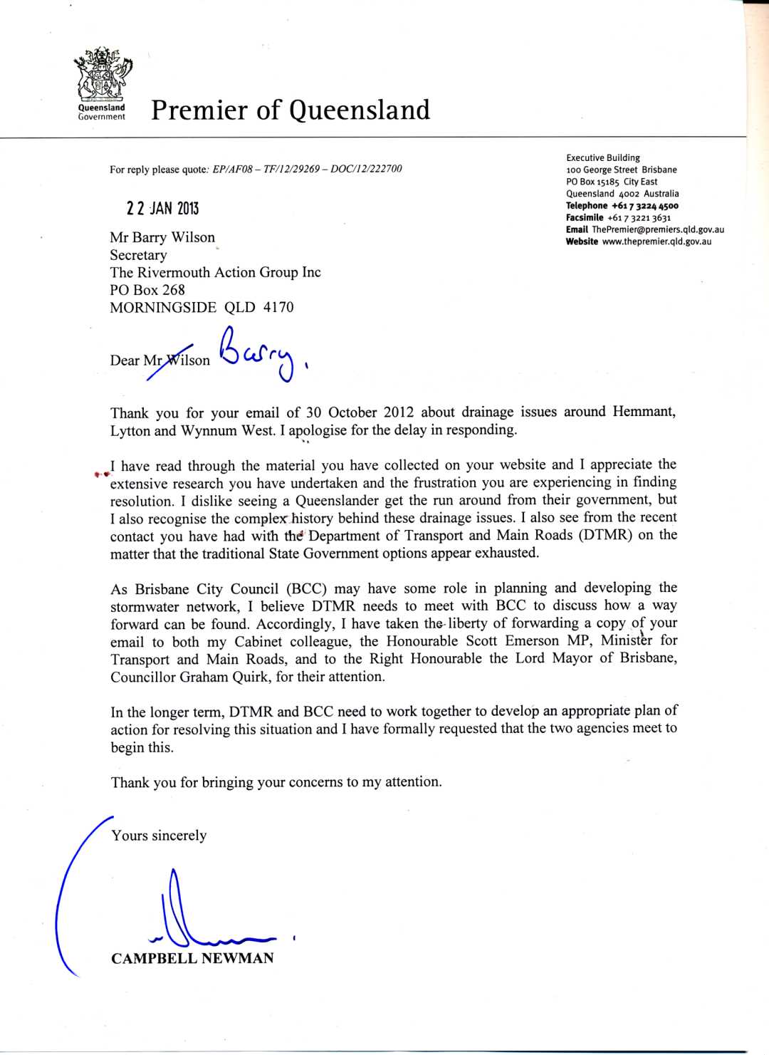
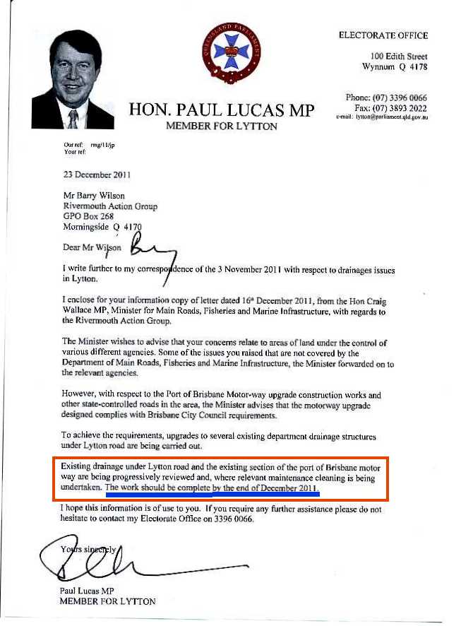
The last time the Premier sent on one of my emails to the Transport Minister for response I had no personal response from the Transport Minister.
Then on the same date from the Lord Mayor.
The Premier is an engineer.
Twelve months (now February 2014) later and still no actions have been taken.
Was the Lord Mayor's letter also written by an engineer? If so, please replace him/her.
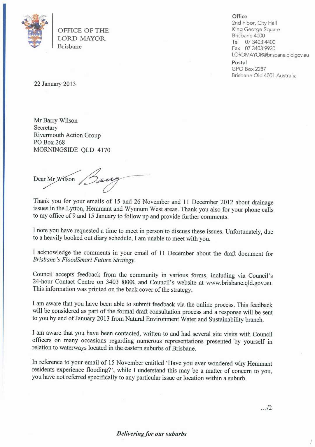
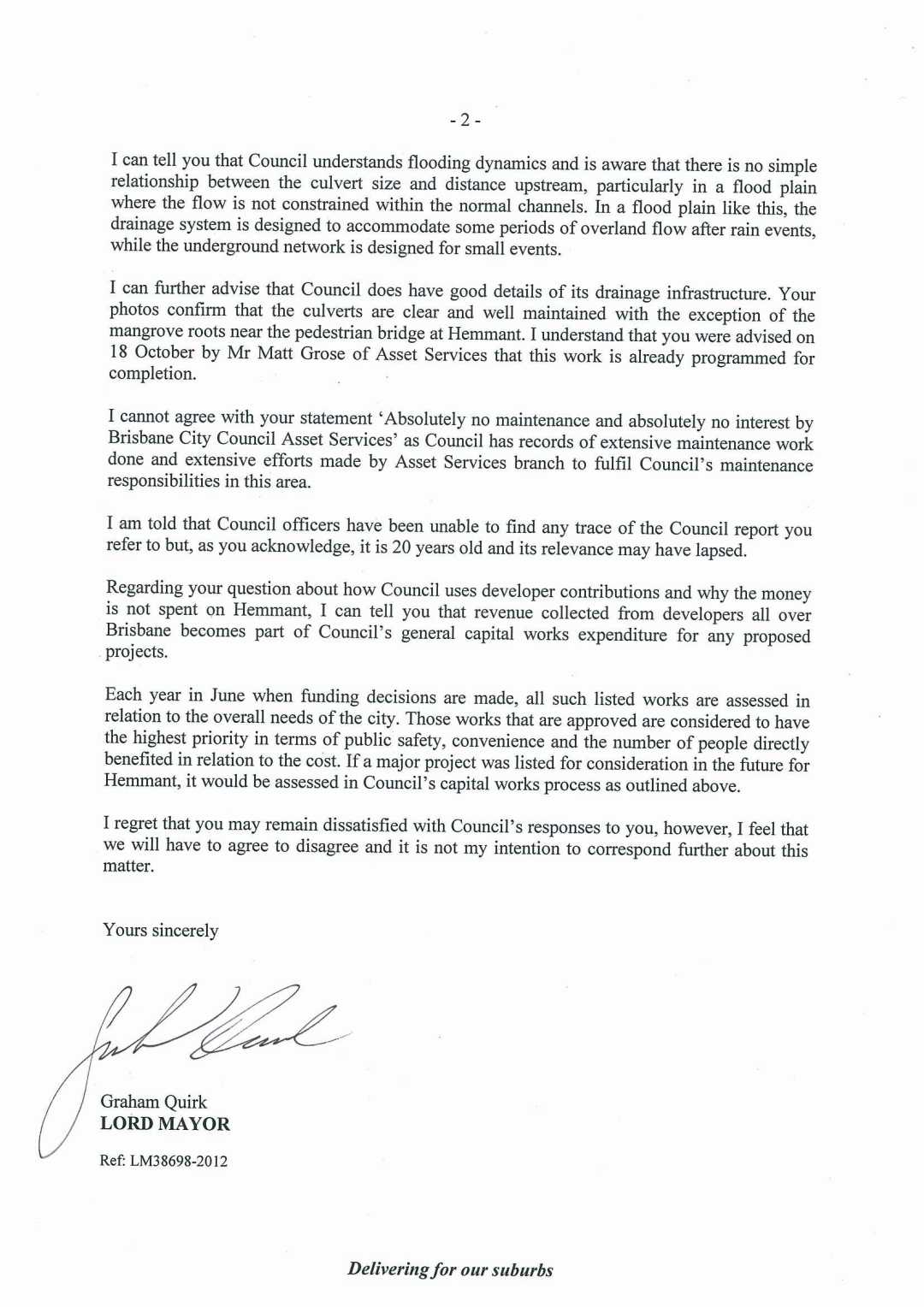
As I only ever met one council officer with his assistant on site at Lytton it is time to expose the author of the Lord Mayor's correspondence.
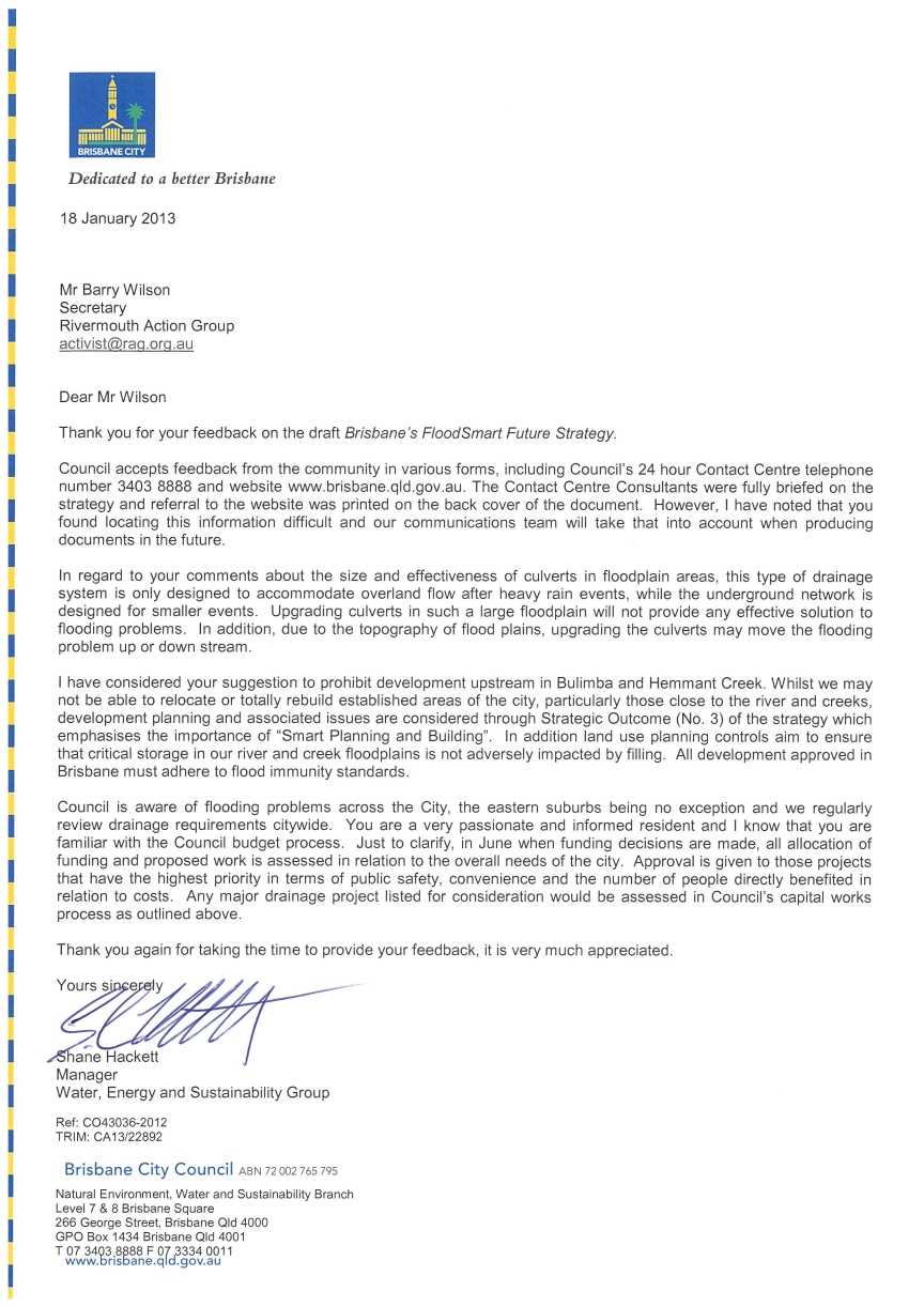
Pages from:
Brisbane City Council had money for this new sign and message.
.jpg)
Now all BCC have to do is SOMETHING THEMSELVES.
NO matter what local home owners do the Brisbane City Council
have not cleaned these pipes out after 18 months (+) of complaints which started well before our last flood in January 2013 but after the February 2012 deluge.
More money on drainage works and then less need for signs.
.jpg)
Photo of Pedestrian bridge over Hemmant Creek between Hemmant & Tingalpa Road and Bulimba Creek.
There has been at least two attempts to clean out these culverts but so far only the mangroves nearby have been removed.
The roots of mangroves in the pipes are years old.
Where was the BCC inspection over the past ten years? Were they always done at high tide?
Let us see if the Brisbane City Council can back up the contents of the Lord Mayor's letter above.
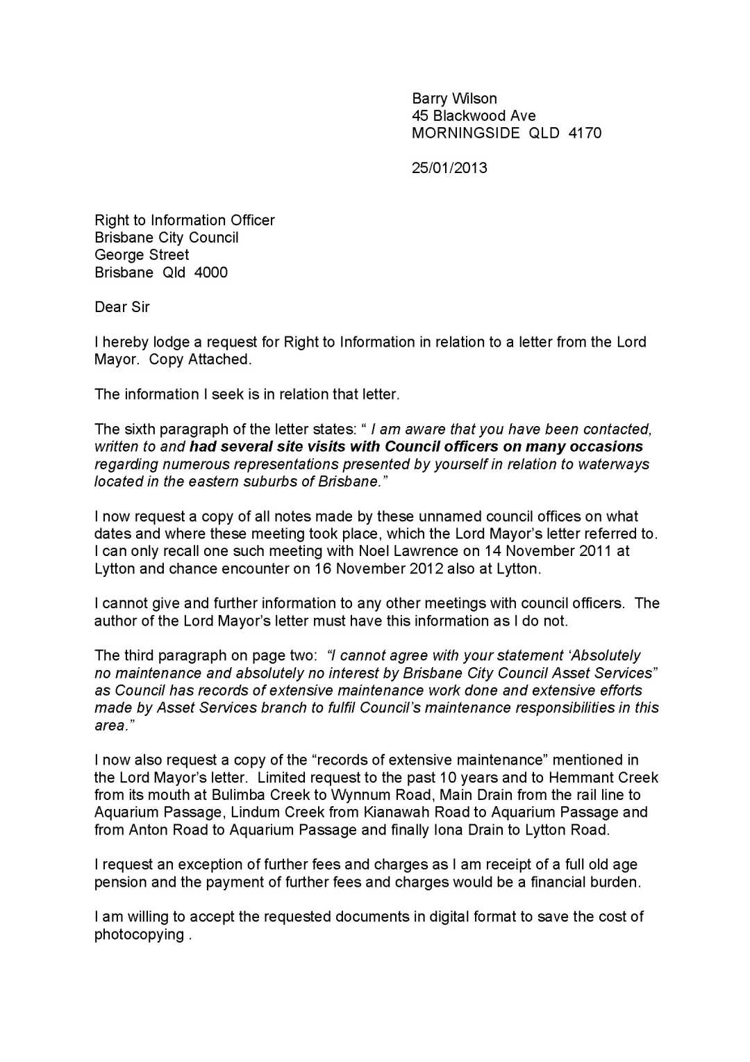

.jpg)
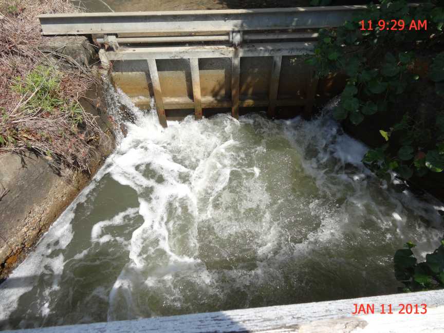
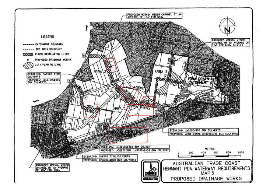
Queensland Rail Shame File #1
8 / 11 / 2012
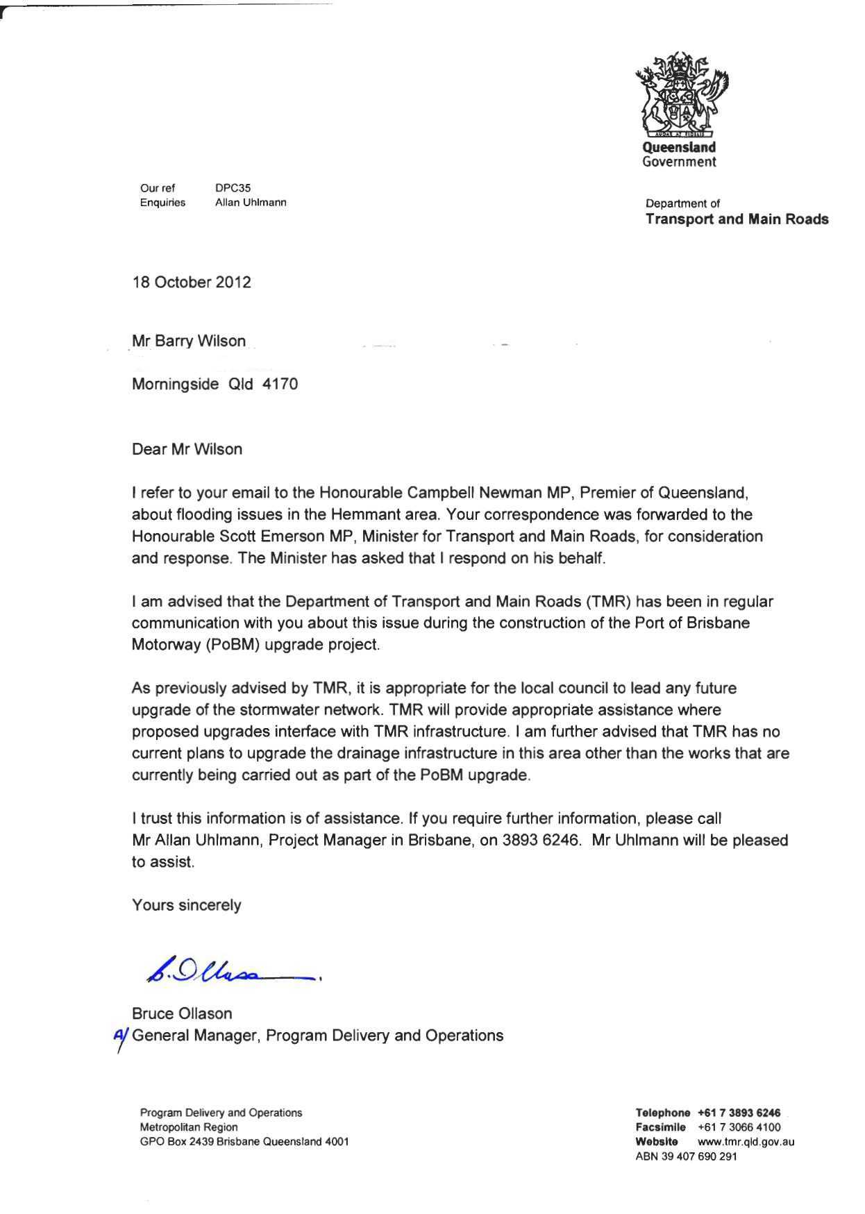
Dear Mr Wilson
I refer to your previous correspondence to Queensland Rail Limited (Queensland Rail) about drainage in the Hemmant to Lindum area.
Queensland Rail has investigated the matter and considers that it has complied with its legislative obligations.
We reiterate our position as stated in our email of 6 September 2012.
Queensland Rail will continue to work with the Department of Transport and Main Roads and the Brisbane City Council to upgrade infrastructure that interfaces with rail corridor where Council has identified a requirement and is providing the necessary funding.
I trust that this information assists you with your enquiry.
Regards
The Customer Feedback Team
Queensland Rail
GPO Box 1429 Brisbane 4001
--------------------------------------------------------------------------------
Queensland Rail’s number one priority is safety. Queensland Rail has a
program of testing for alcohol and other drugs. Please be aware any person who
enters a Queensland Rail premises for business purposes may be randomly tested
for alcohol (breath test) and other drugs (oral fluids test). Please also ensure
you are wearing the appropriate Personal Protective Equipment for the site you
are visiting. Call your Queensland Rail contact person if you need more information.
This email (which includes all attachments and linked documents) is intended for and is confidential to the addressee; it may also be subject to legal professional privilege or otherwise protected from disclosure. If the addressee is a government agency in receipt of a Right to Information Act (2009) application in relation to this email, contact must be made with Queensland Rail Ltd ACN 132 181 090 in accordance with the third party consultation process provided for in Part 3, Division 3, Section 37 of that legislation. If you are not the addressee, or if you have received this email in error, you must not use, rely upon, disclose or reproduce it (or any part of it) in any way. Please notify the sender of your receipt of it and delete it in its entirety. Neither Queensland Rail Ltd (or any of its related entities) accepts any liability for computer viruses, data corruption, delay, interference, interception, unauthorised access or amendment of this email. The views expressed in this email, unless clearly stated otherwise, are the views of the sender. They do not necessarily represent the view or policy of Queensland Rail Ltd or any of its related entities.
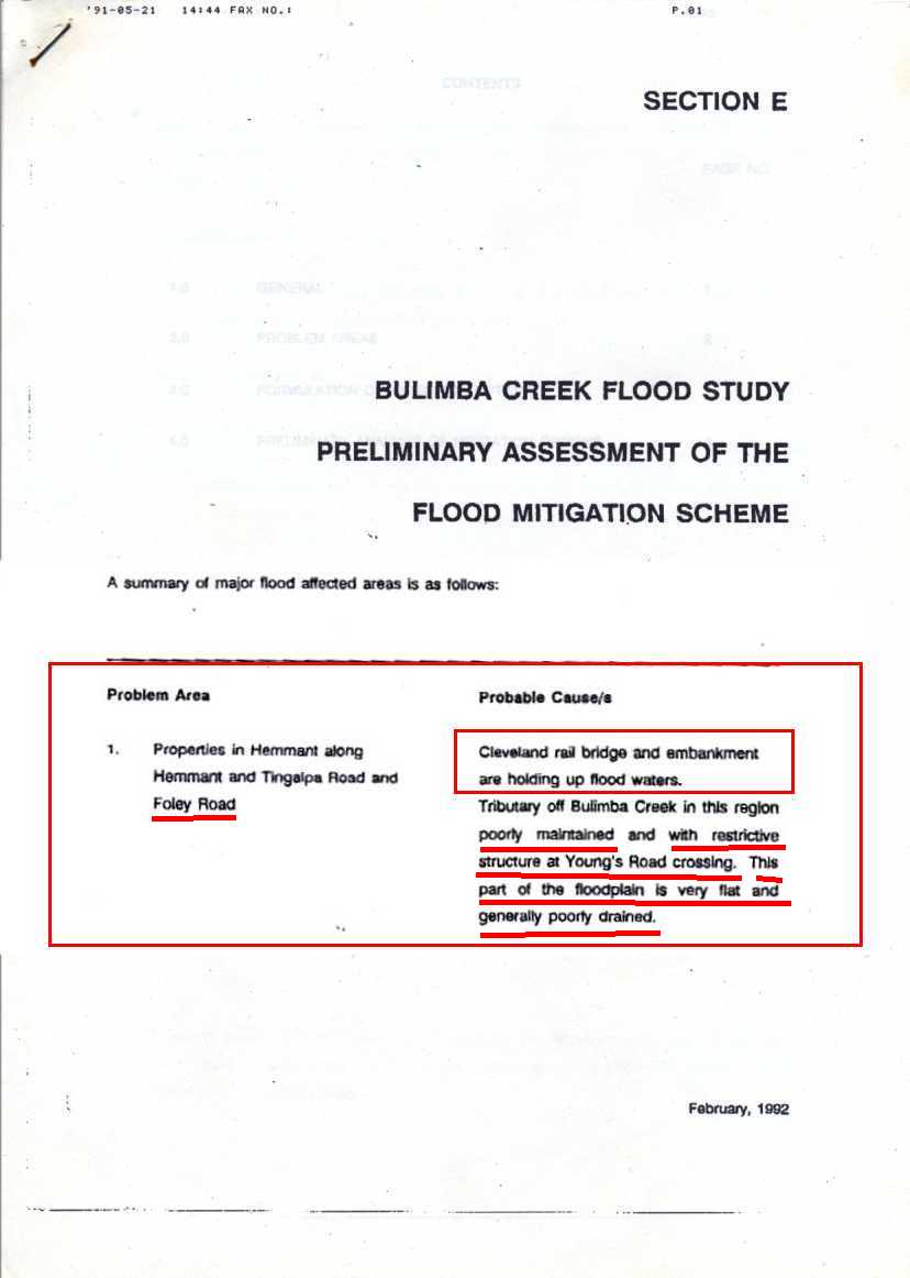
Industrial Planning Unit Department of Development and Planning
July 1992 Brisbane City Council.
Page ii "SOCIAL ISSUES
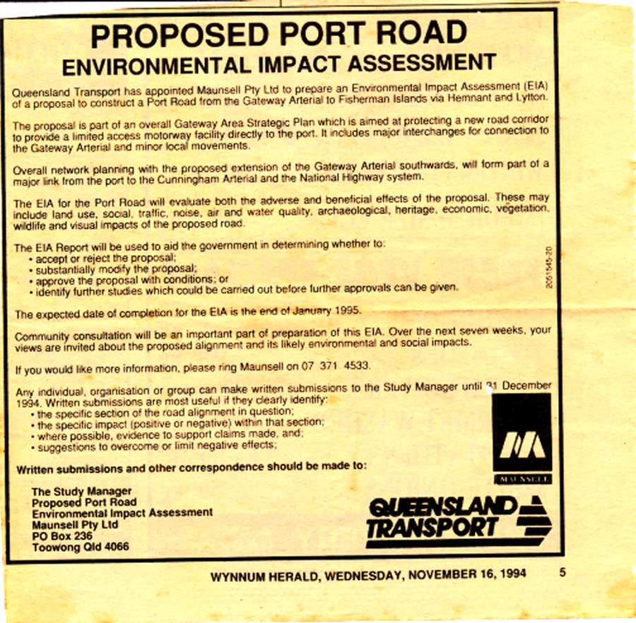
"A major shortcoming of the Study was that no programme of community consultation was undertaken because of the nature and confidential status of possible alignment for a Port Road Corridor. This restricted both the development of an accurate social profile and, more seriously, forced the Study Team to develop a plan without any community input. ...."
The following is part on one of my own submissions
Filling is taking place throughout the Lytton Road East development area. The amount of fill placed in what was a flood plain is incredible, some even without Brisbane City Council approval. Many of the companies have undertaken drainage works within their properties but they abut other properties or roads where no further work has been carried out. Examples of this exist in Hemmant, such as Gosport Street near the Queensport Hotel and west of the Lytton Road and Lindum Road intersection.
The dual gauge rail line to the Port placed more fill within the flood plain, yet no work was undertaken to increase the drainage to the Brisbane River or Bulimba Creek.
The Proposed Port Road will require a massive amount of fill to keep the road above the 100 year flood, and it intended to be built to 100 km/hr specifications, four lanes width. Invariably, inadequate drainage outlets will be provided beneath this road. Even if large open sections are left beneath the Port Road, the Brisbane City Council has then to dig drainage channels to the riverfront, or creek edge. This is not happening at present.
page 3-25 "Table 3.10 Estimate Culvert Costs (LYTTON ROAD EAST DEVELOP STUDY 1992)
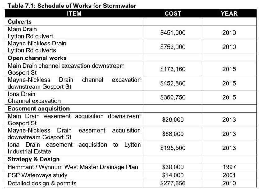
Almost $½ million dollars was required in July 1992
STOP PRESS
9 October 2012
Port Connect has advised that the increased drainage upgrade beneath Lytton Road, Lytton at the drainage channel known as Channel 4 will only be increased by one more (not two as planned) 1800 pipe making the total of five.
This provides a drainage capacity of 12.5 square metres for a catchment of 266.3 ha
The catchment area for the Lytton Industrial Estate (Channel 2 and 3) is 118.7 ha and the drainage capacity under the Port Road is nine pipes at 1950 making a total of 36 m2 and then downstream flow (adjacent) under Lytton Road has five pipes of 1950 on Channel 2 plus 6 x 2400 x 1200 box culverts at Channel 3 giving a drainage capacity of 30 m2.
In short the Government Industrial Area has drainage in excess of 5 times the capacity of the next catchment.
266.3 ha = 12.5 m2
118.7 ha = 30 m2
Awaiting a URGENT response from the Queensland Transport Minister.
ARRIVED
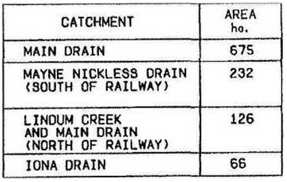
Information from Port Connect on catchment areas (below)
Bulimba Creek – 12500 ha
Lindum and Main Drain – 400.4 ha
Channel 2 and 3 – 118.7 ha
Channel 4 – 266.3 ha
Port Connect Information (below)
| Channel | Existing Motorway | New Motorway construction | Existing Lytton Road | Lytton Road after motorway construction |
|
Channel 2 (adjacent to Recochem) |
N/A | 3 x 1950 pipes | Bridge | 5 x 1950 pipes |
|
Channel 3 (East of Freight Street) |
N/A | 6 x 1950 pipes | 3 x 2400 x 1200 box culverts | 6 x 2400 x 1200 |
|
Channel 4 (Green Corridor) |
N/A | Bridge | 4 x 1800 pipes |
Designed 6 x 1800 pipes NOW TO BE 5 x 1800 pipes |
|
Lindum Creek Mayne Nickless Drain |
Bridge |
Bridge (Duplicated) |
5 x 1500 pipes * | No change |
| Main Drain |
2 x 2700 x 1500 box culverts |
2 x 2700 x 1500 box culverts (extended) |
3 x 1500 pipes * | No change |
| Bulimba Creek | Bridge |
Bridge (duplication) |
Bridge | No change |
* Metropolitan Region asset - outside Port Connect Scope
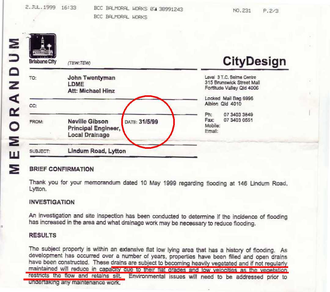
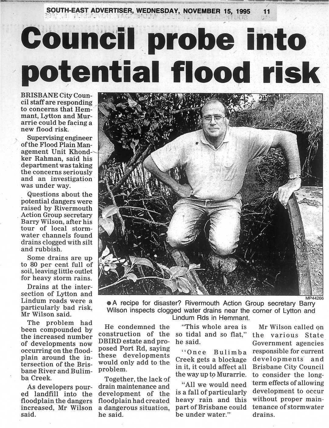

As you read the following web site consider that most decisions that were made which caused the problems, or not fixing the drainage problems or making the problem worse were made by qualified engineers who are most probably members of Engineers Australia. As such are subjected to the Engineers Australia's By-laws and Code of Ethics also the Queensland Board of Engineers will accept complaints.
I honestly believe that it is about time that ALL such engineers involved in this drainage dilemma must now be brought to task.
Because of this I will be lodging complaints against every engineer I can find who has been associated with any of the negative aspects of the issues contained within this Lytton/Hemmant web site.
I recommend that readers consider such actions as well.
From Engineers Australia Web site
http://www.engineersaustralia.org.au/about-us/complaints-against-members
Making a complaint
Anyone can lodge a complaint against a member of Engineers Australia. All complaints must:
•Be in writing
•Clearly explain the circumstances that gave rise to the complaint
•Provide evidence to support the allegations
•Include all documentation relating to the allegations ('drip feeding' of relevant information will only result in delays)
•Detail any prospective or ongoing tribunal or legal proceedings in relation to the matters raised
•Include your full name and contact details.
Complaints should be addressed to:Complaints Commissioner
Engineers Australia
11 National Circuit
BARTON ACT 2600
Our Code of Ethics defines the values and principles that shape the decisions we make in
engineering practice. The related Guidelines on Professional Conduct provide a framework
for members of Engineers Australia to use when exercising their judgement in the practice
of engineering.
As members of Engineers Australia, we commit to practise in accordance with the Code of
Ethics and accept that we will be held accountable for our conduct under Engineers Australia’s
disciplinary regulations.4. Promote sustainability
4.1 Engage responsibly with the community and other stakeholders
a) be sensitive to public concerns
b) inform employers or clients of the likely consequences of proposed activities on the community and the environment
c) promote the involvement of all stakeholders and the community in decisions and processes that may impact upon them and the environment
4.2 Practise engineering to foster the health, safety and well-being of the community and the environment
a) incorporate social, cultural, health, safety, environmental and economic considerations into the engineering task
4.3 Balance the needs of the present with the needs of future generations
a) in identifying sustainable outcomes consider all options in terms of their economic, environmental
and social consequences
b) aim to deliver outcomes that do not compromise the ability of future life to enjoy the same or better
environment, health, well-being and safety as currently enjoyed.
If any reader would like to join our group's complaint please send me an email to activist@rag.org.au
A Right to Information (Freedom of information) request on the Queensland Government will make available the names of the engineers involved.
The names of those involved will be available upon request once available.
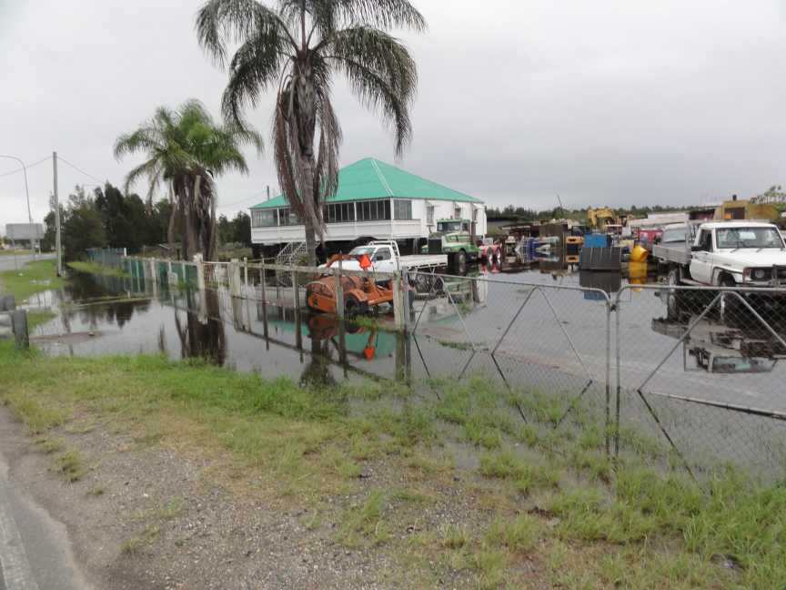
A.U. Advised that drains are not entirely blocked off during construction. The impacts of rain events are actively managed to balance the effects on the site and upstream areas.
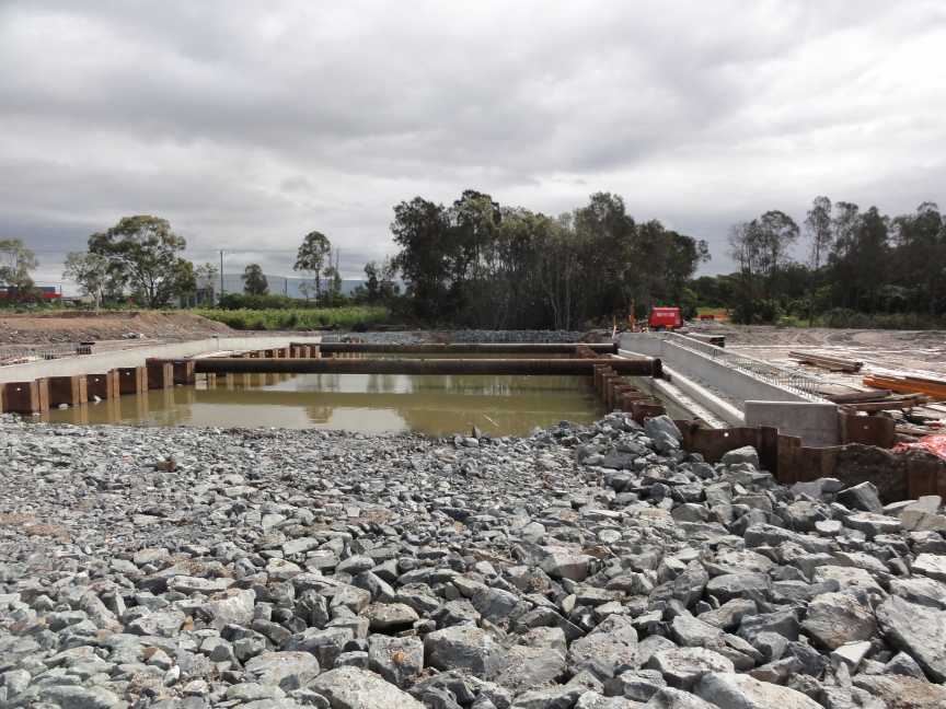
Port Connect information (16 Aug 2012)
1. The new rock lined section of Channel 4, between the Motorway and Lytton Road, has a 12m base width and 1V:2H side slopes. Please note that a smaller channel width would have functioned hydraulically, but tapering in from the bridge spill through width to the smaller channel width and tapering back out to the Lytton Road culvert width was not considered practical. Therefore, a consistent (larger) channel width was adopted.
2. The additional modelling and report, regarding Channel 4 and based on the existing Port Connect hydraulic model, has not yet been completed. We anticipate this will be finalised by the end of August (2012) and submitted to the Port of Brisbane Pty Ltd for their decision making process.
Now read a page of BCC document.
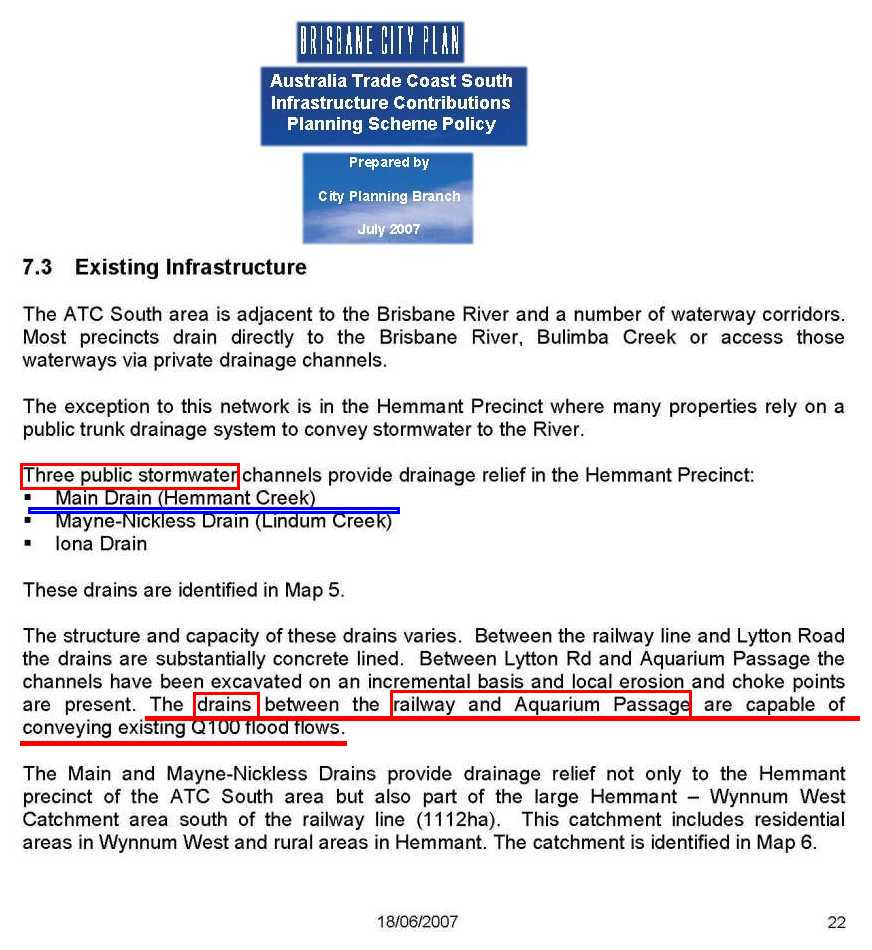
Note the size of channel recommended upstream (27 m) and then only part of the catchment which will need to flow through the Port Road channel (12 m) above (in the photo).

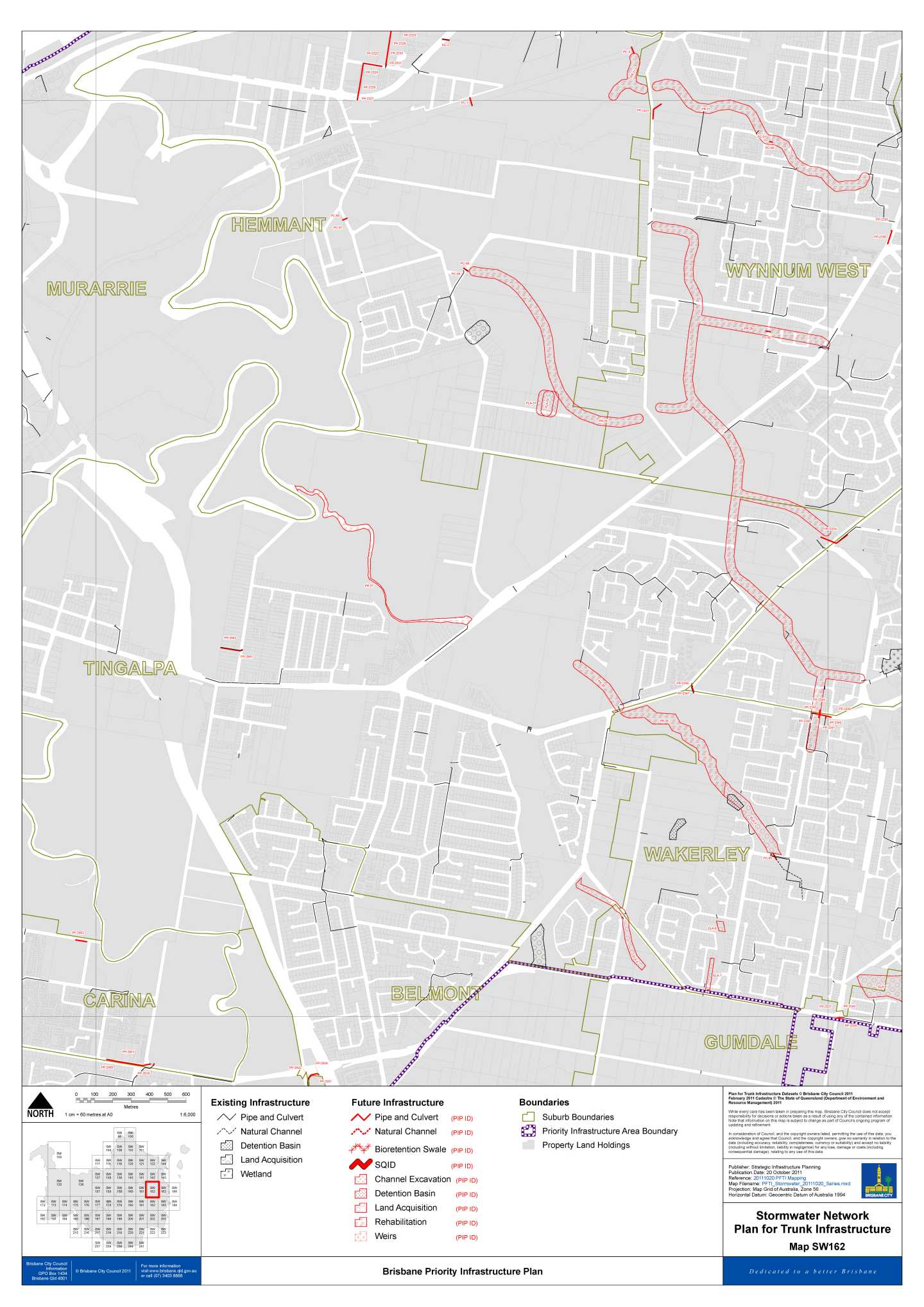
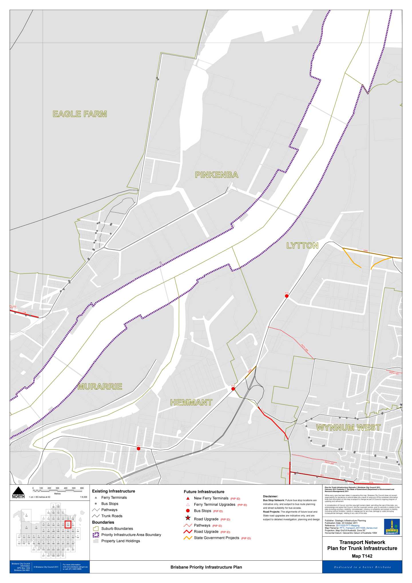
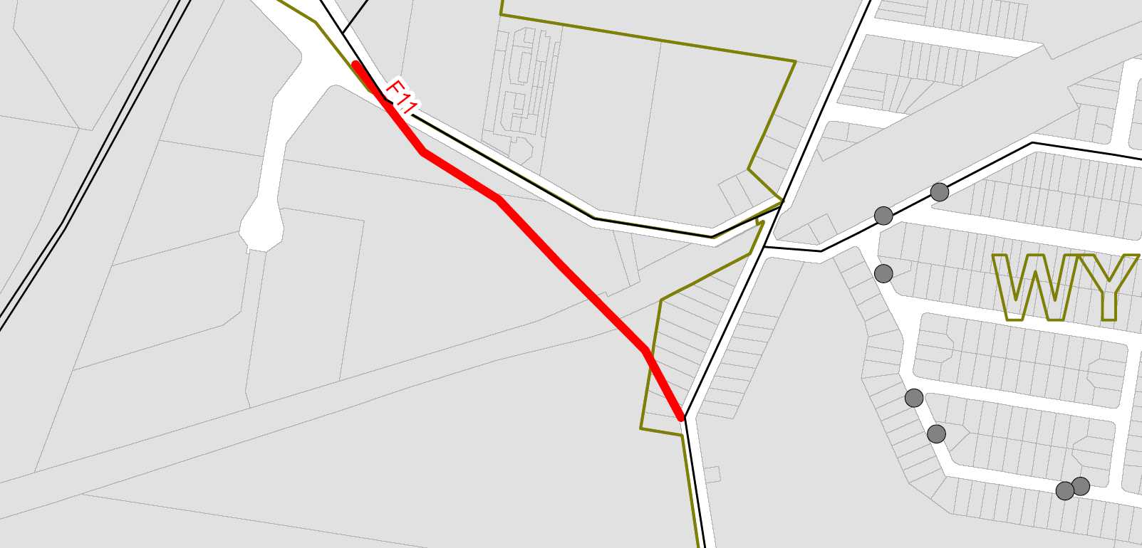
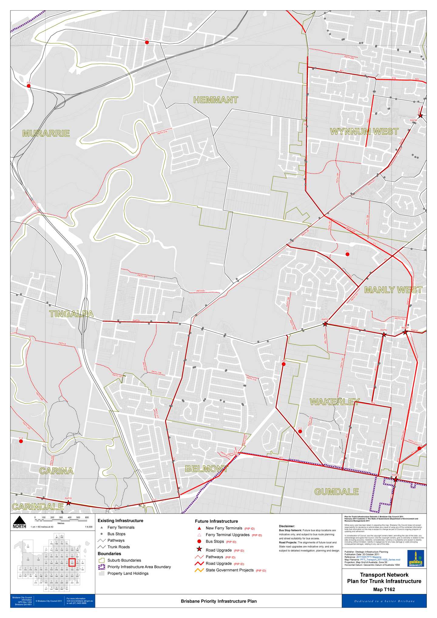
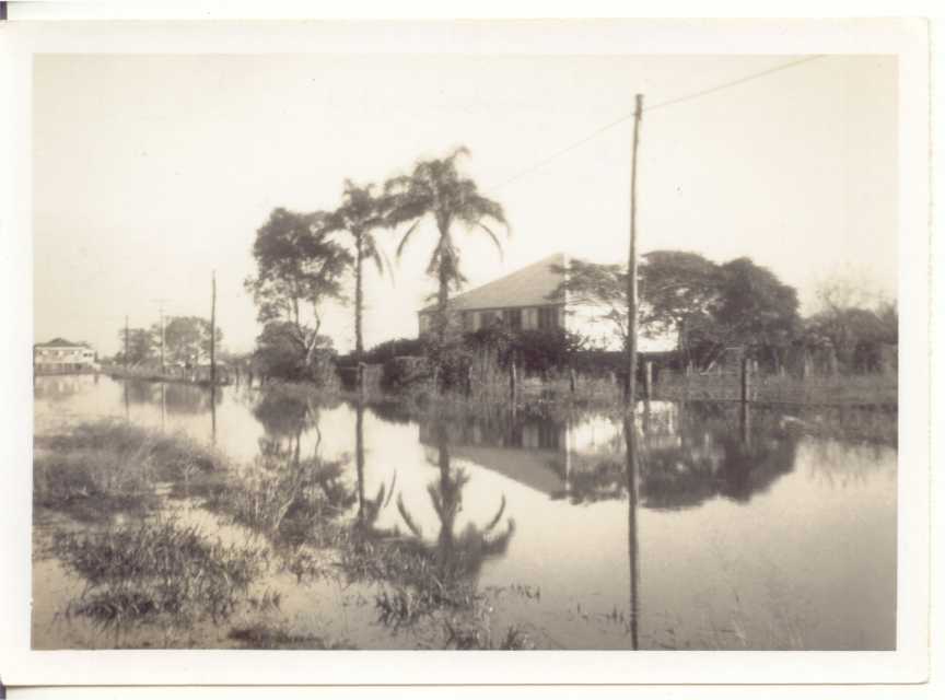
!937 Map of this general area. Notice areas of mangroves and
reclamation area along river banks.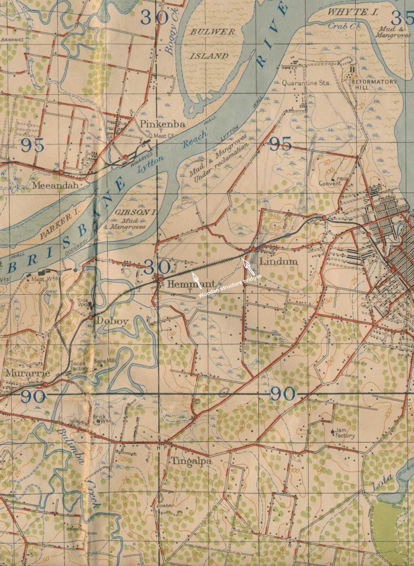

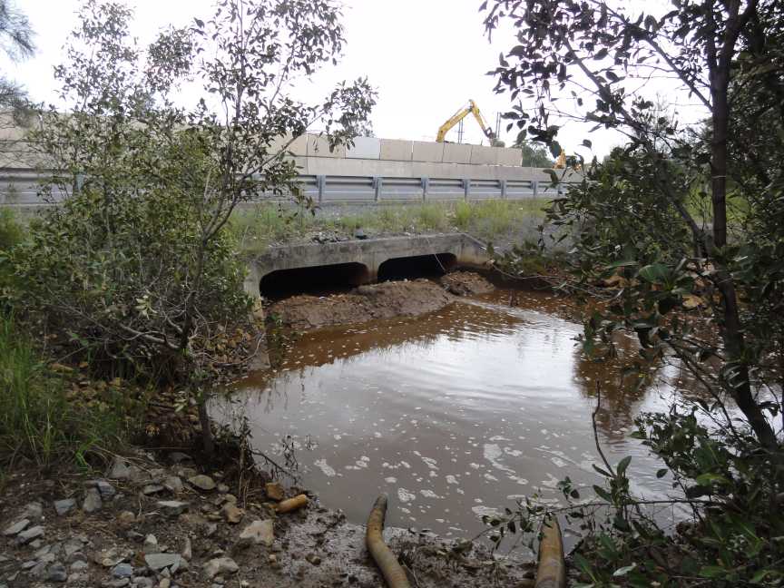
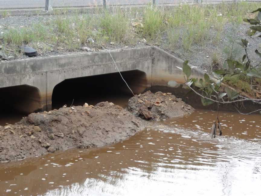
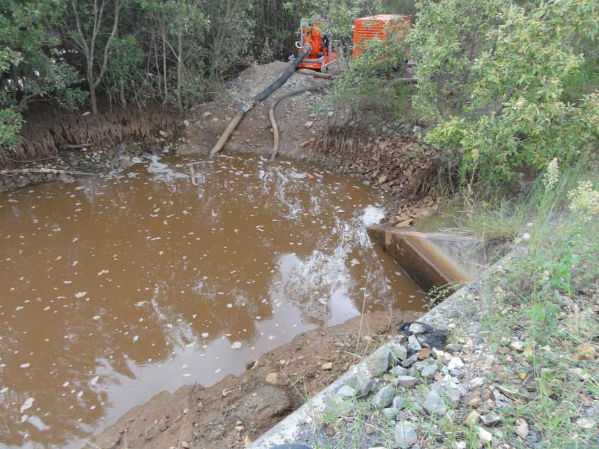
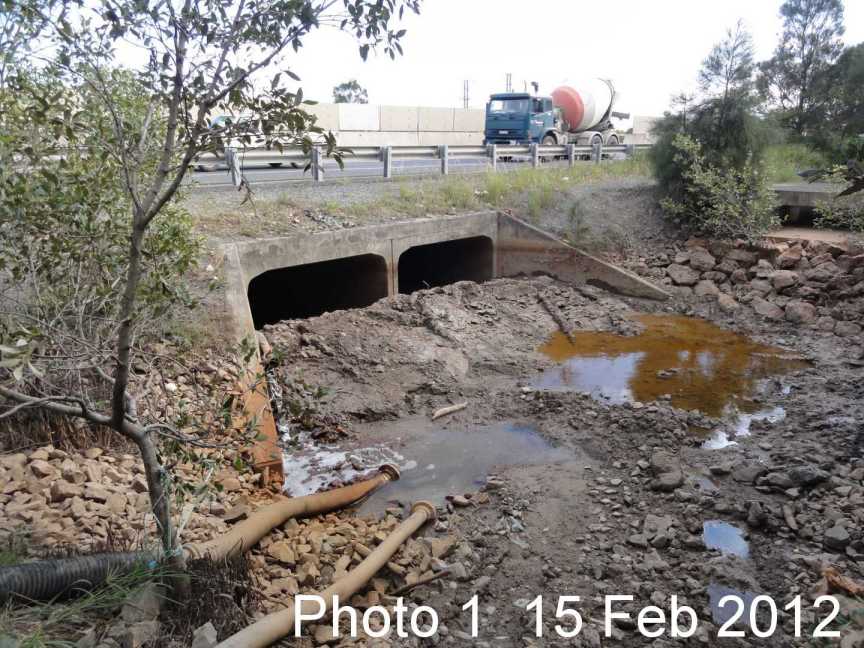
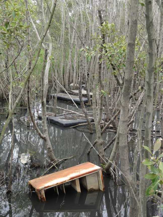
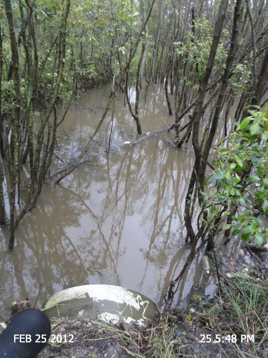
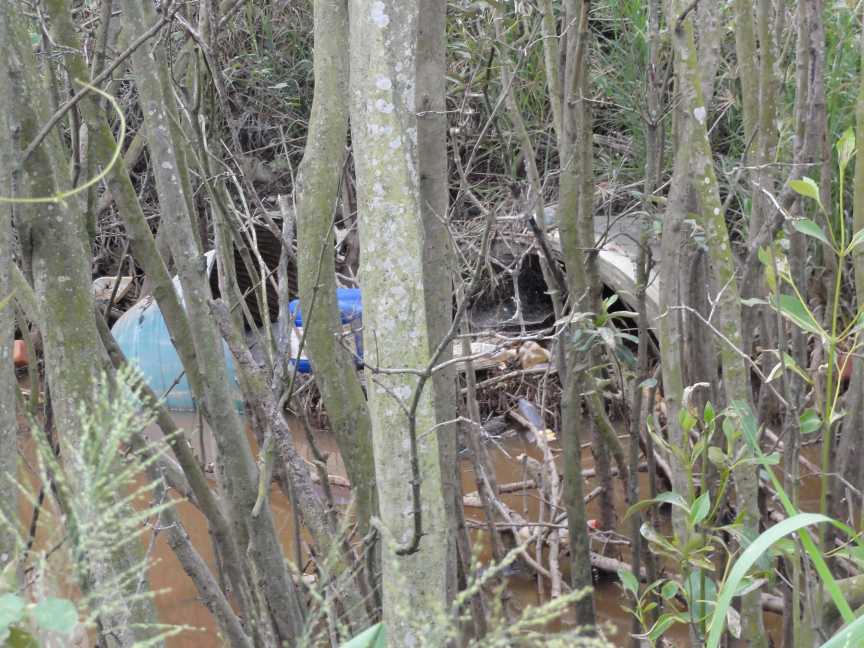
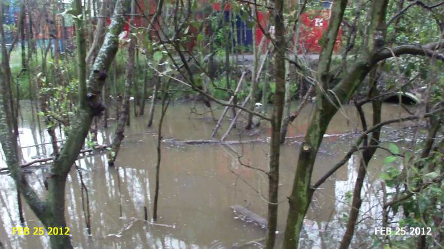
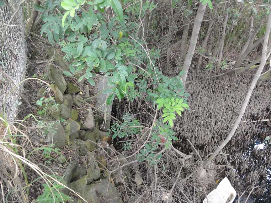
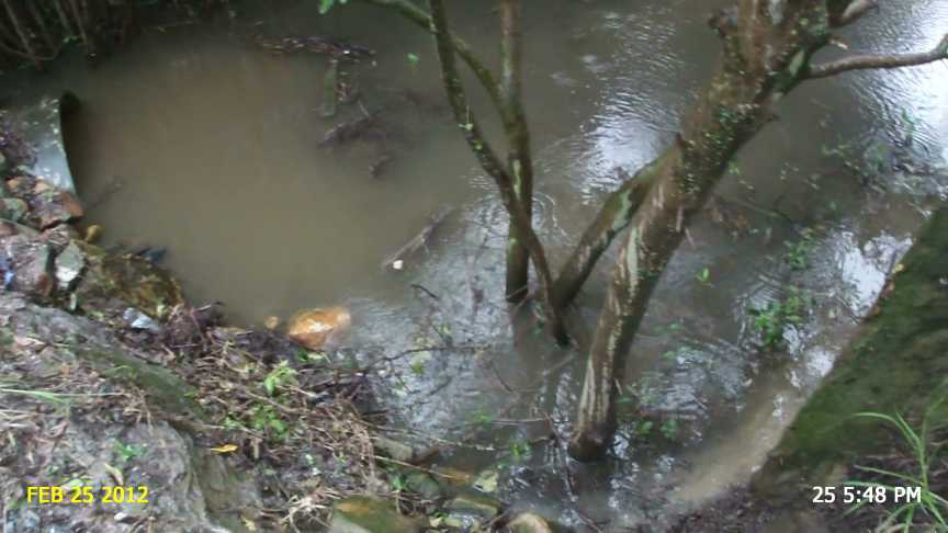
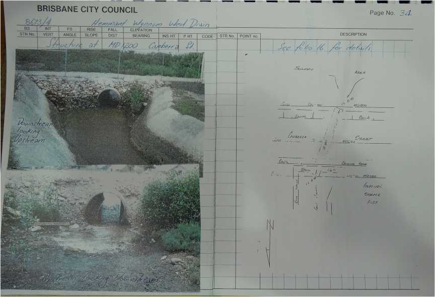
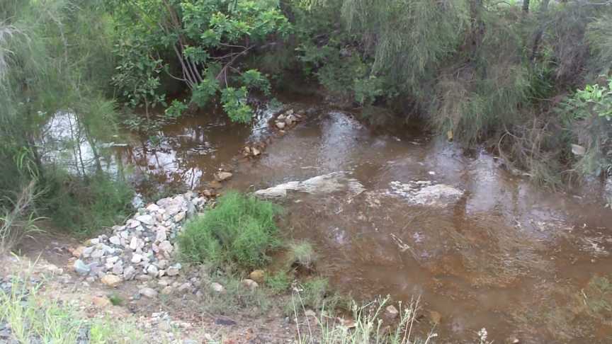
.jpg)
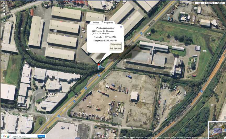
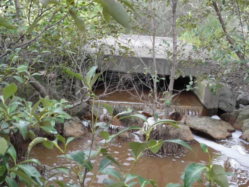
"TMR is aware that one of the contributing factors to local drainage issues is the condition of land owned by the Port of Brisbane Pty Ltd (POBPL) between Lytton Road and the Brisbane River. These concerns have been raised with POBPL."


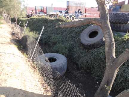
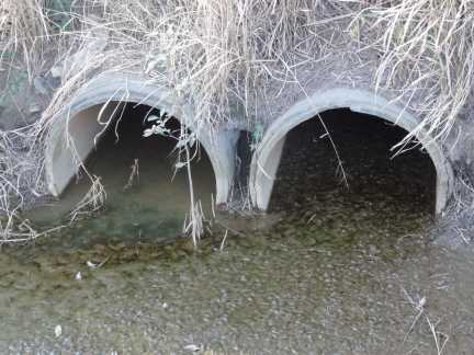
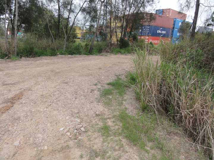
.jpg)
.jpg)
.jpg)
.jpg)
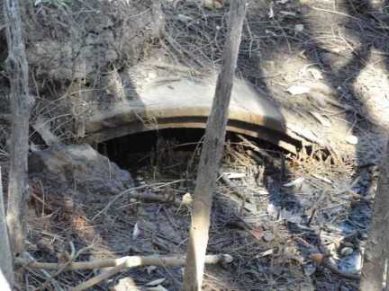
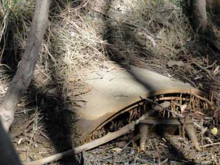
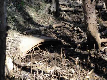
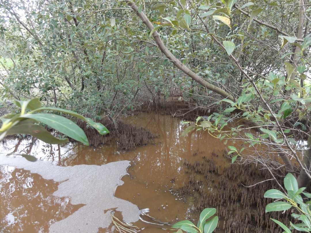
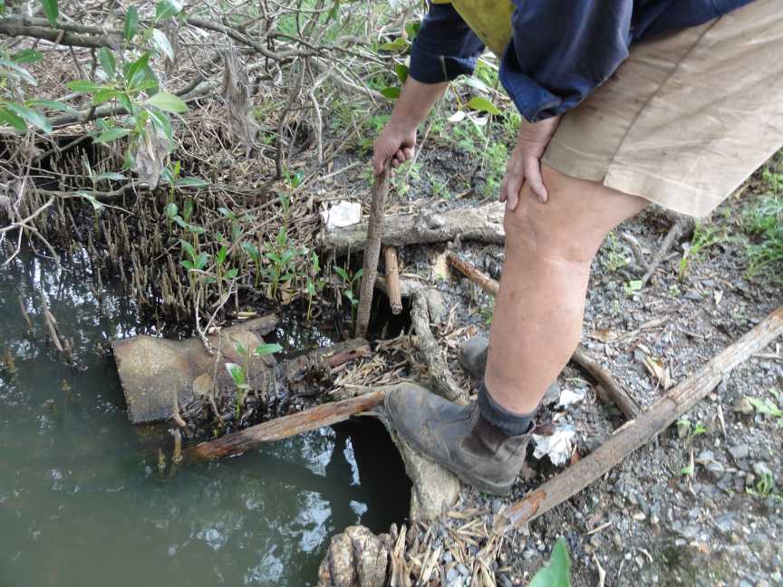
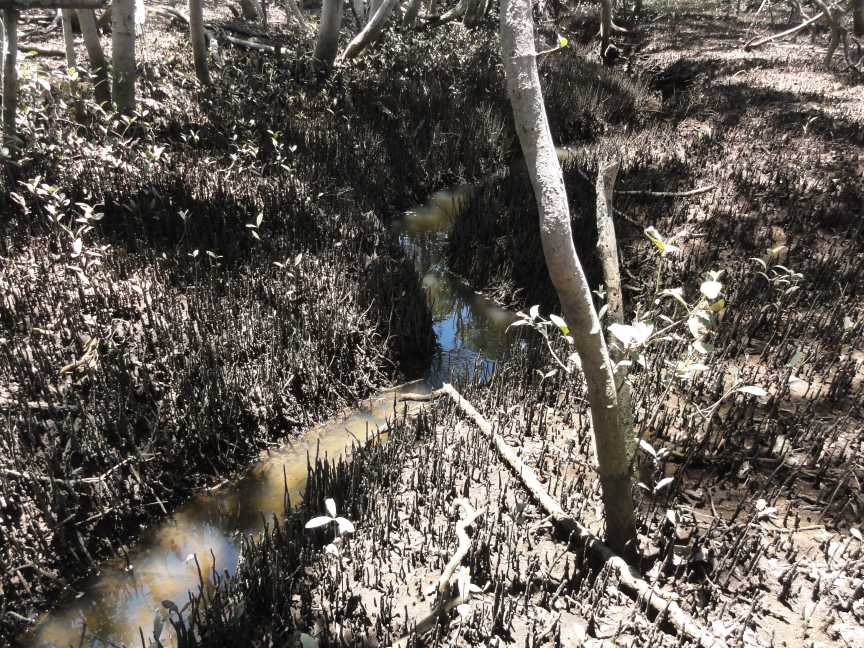
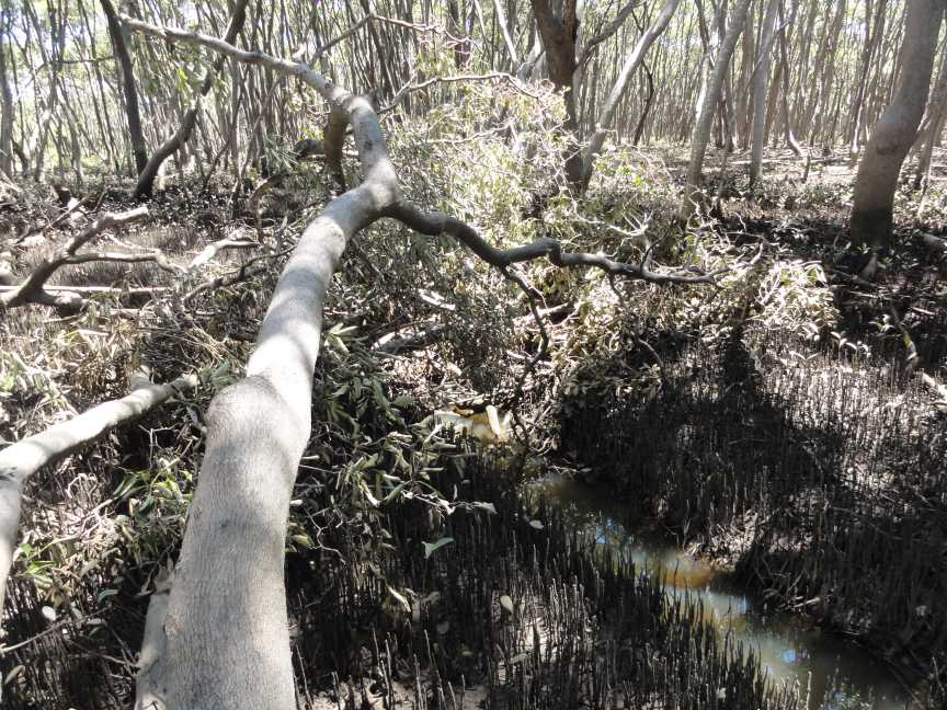
In January 2013 the Port of Brisbane Pty Ltd excavated a drainage channel from Lytton Road through towards the Brisbane River. This previously blocked section of drain has now lowered the water level at low tide at Lytton Road by about a metre but on a very low tide may be even more of a reduction. As the obstructions up stream of Lytton Road and new Port of Brisbane Motorway have not been removed much of the improvement has not eventuated.
.jpg)
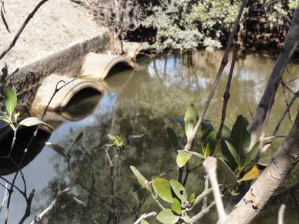
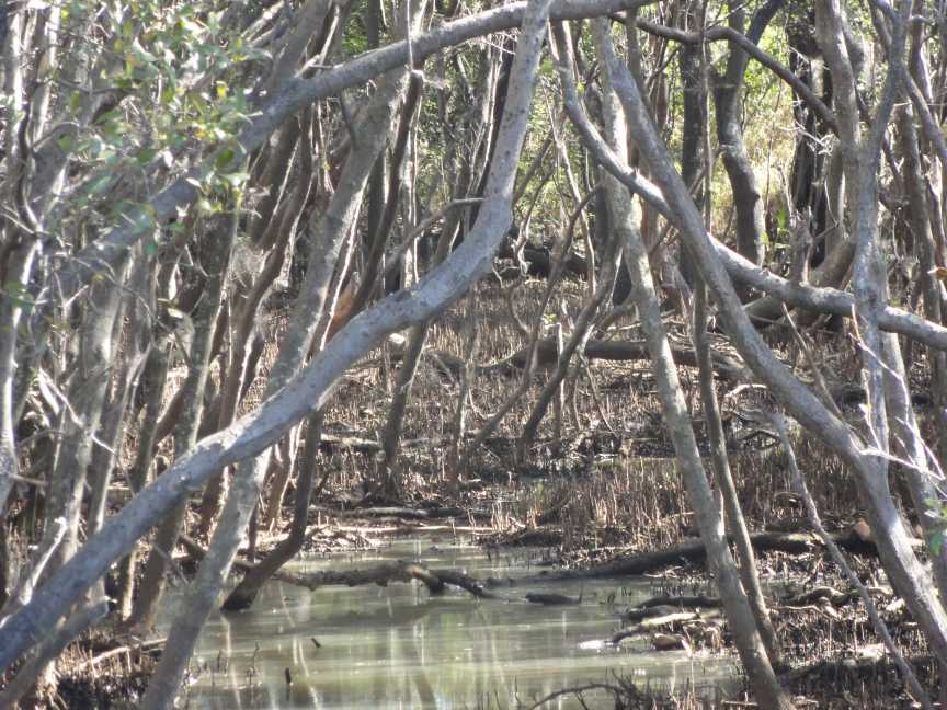
1. The new rock lined section of Channel 4, between the Motorway and Lytton Road, has a 12m base width and 1V:2H side slopes. Please note that a smaller channel width would have functioned hydraulically, but tapering in from the bridge spill through width to the smaller channel width and tapering back out to the Lytton Road culvert width was not considered practical. Therefore, a consistent (larger) channel width was adopted.
2. The additional modelling and report, regarding Channel 4 and based on the existing Port Connect hydraulic model, has not yet been completed. We anticipate this will be finalised by the end of August and submitted to the Port of Brisbane Pty Ltd for their decision making process.
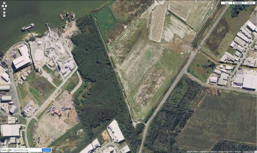
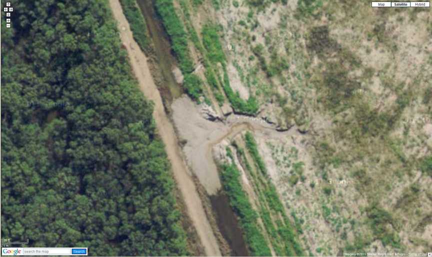
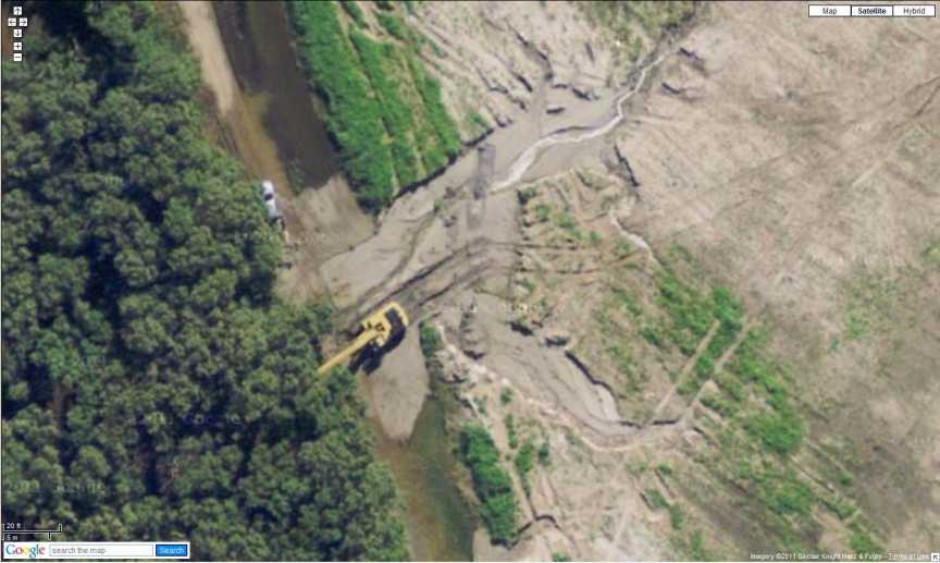
.jpg)
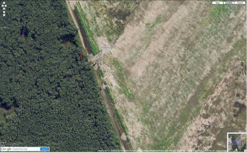
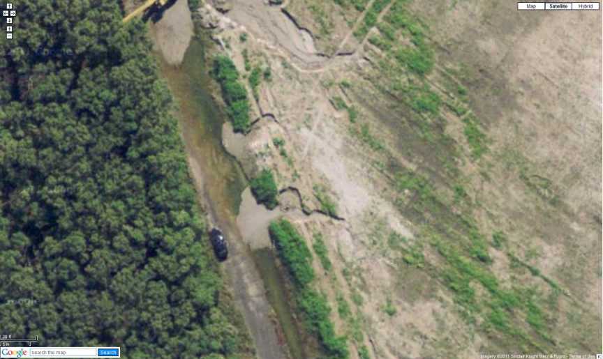
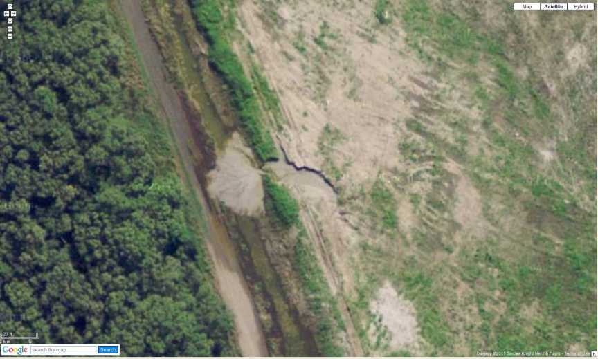
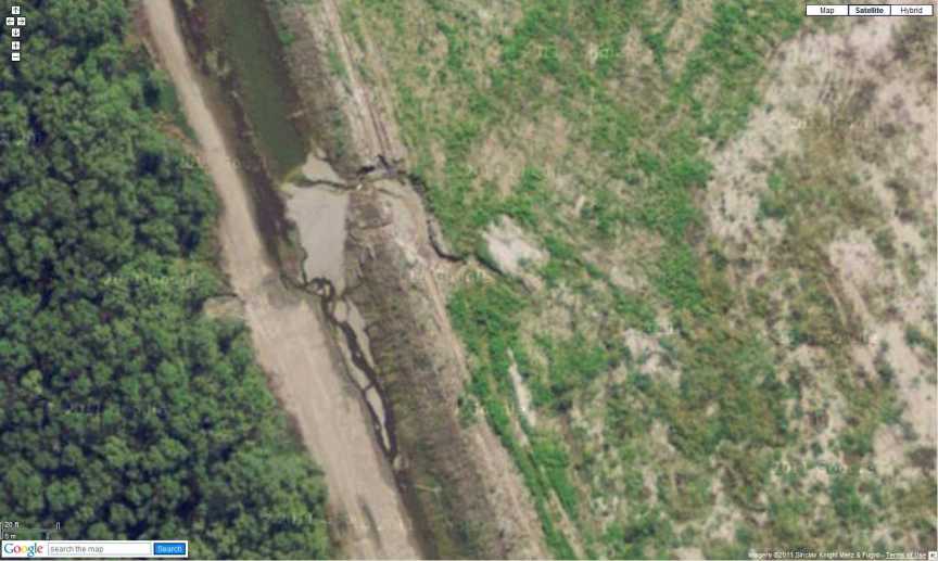
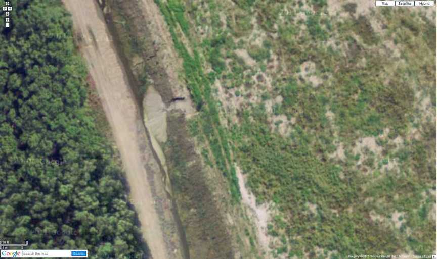
27º 25' 57.4" S 153º 8' 24" E
Photograph taken 8 August 2011 @ 9:50 am
Low Tide Brisbane Bar 10:21 am
Quite obvious this drainage in not working except to those whose job it is to inspect and maintain.
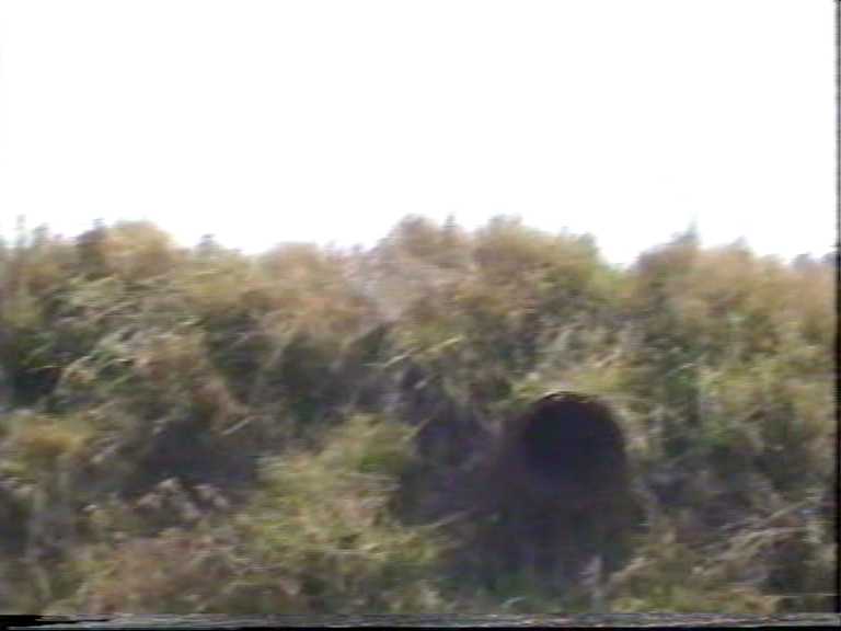
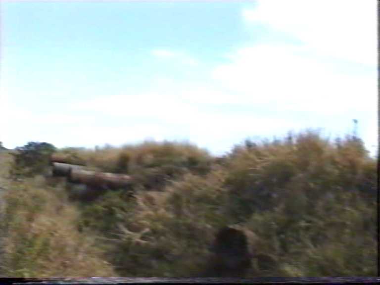
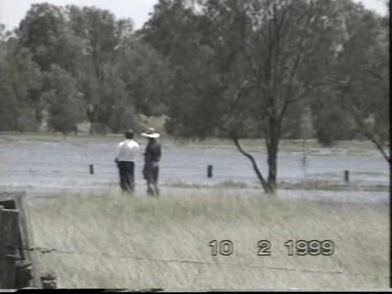
Several years ago I made a video which showed three of these culverts fully blocked and the fourth more that 3/4 blocked. It took a further two years for any work to be carried out to clean them out. It is a impossible to now see if the culverts are or could fully function during heavy rain because the water level is not changing with tidal influence as it should.
These images have been taken from video 8 tape made on 28 February 1997 as you can see some company had put a concrete slab across the drainage corridor about half way up the the height of the pipes. 20 months after my first video on 2 June 1995.
Eastern side of Lytton Road showing concrete slab which inhibits drainage under Lytton Road then through Port West (looking south). 28 February 1997
Looking upstream (to East) through the same culverts above where you can see the concrete slab. 28 February 1997
This was the excavator used in 1997 to clean out the culvert on the downstream side of Lytton Road. Again some 20 months after my complaint about blockage.
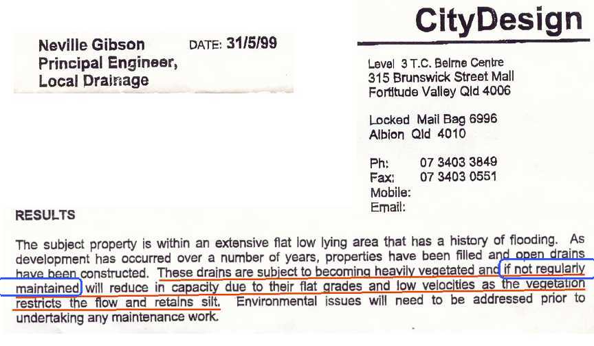
What the Lord Mayor said about this drainage in 2002!


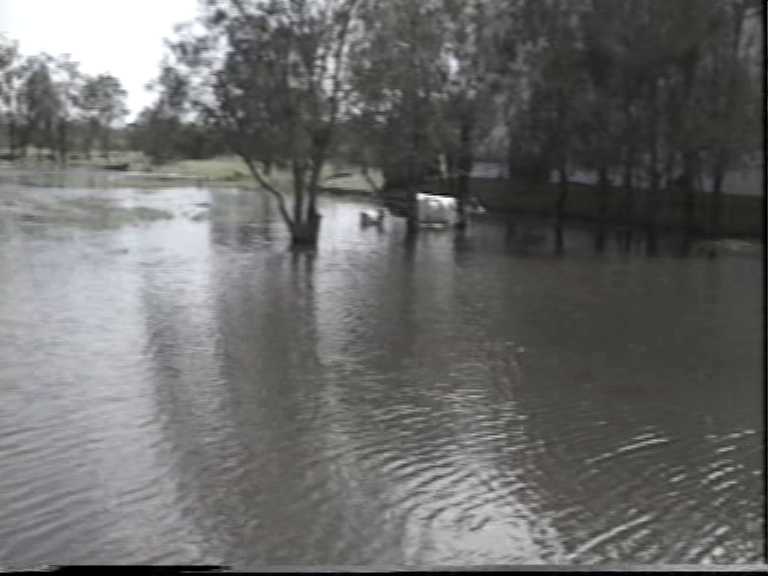
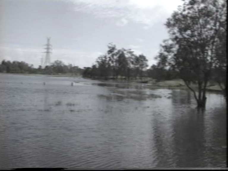
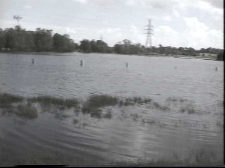
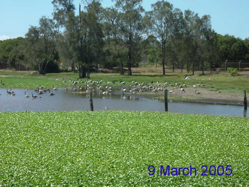


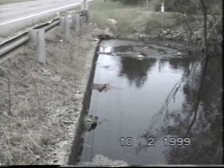
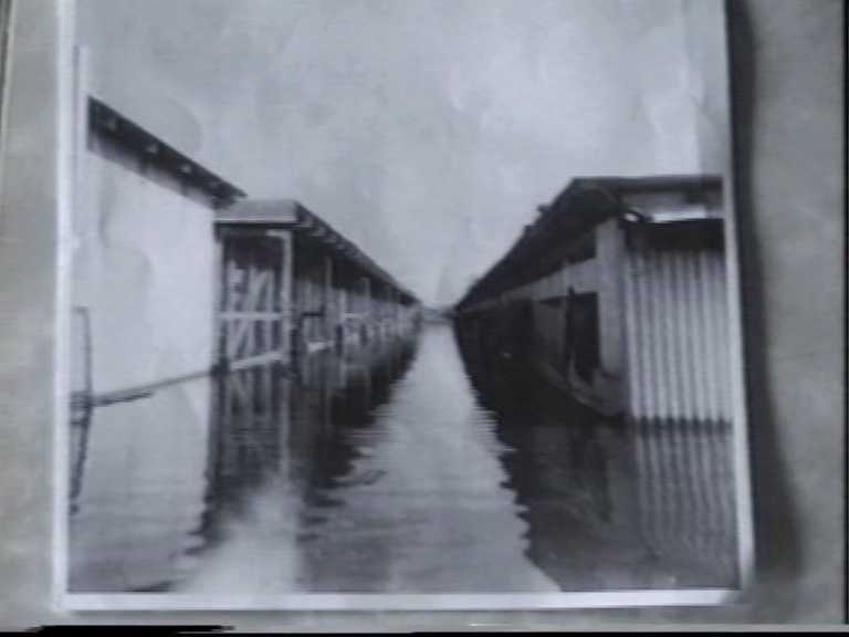
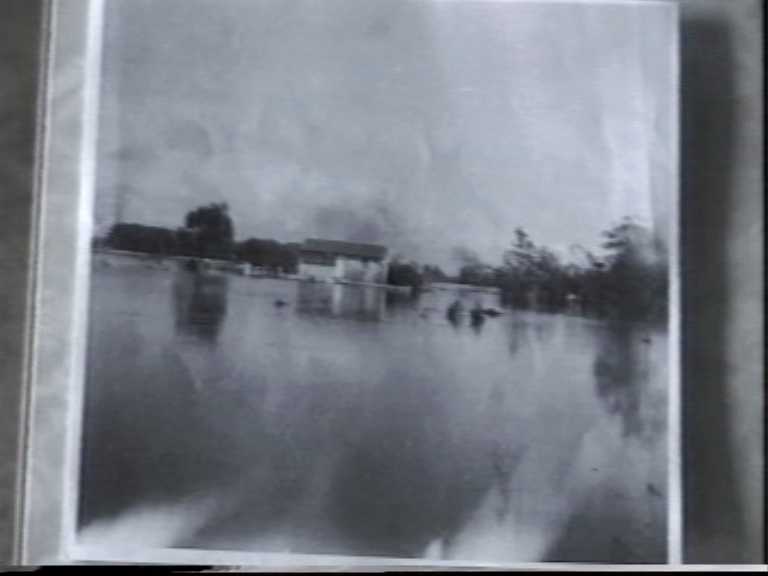
Local residents, and there only a few of us now, who lived in Lindum Road, Lindum (now Lytton) who have been subjected to unnecessary flooding of their property since Lytton Road was upgraded some 40 years ago to allow for the transportation of fuel from the Ampol refinery built at Lytton and the building and access to the developing Port of Brisbane at Fisherman Islands.
During the latter part of the 1960's an upgrade of Lytton Road started at Bulimba Creek at Hemmant continued to the intersection with Hemmant & Tingalpa Road then instead of turning left into what is now Aquarium Avenue and then along what is now Gosport Road, the new Lytton Road went straight ahead across the intersection across what could only be described as near intertidal wetlands covered with salt cooch and stunted mangroves growing on a acid sulphate soft clay expanse to its intersection with Lindum Road.
This new Lytton Road was built up some 2+ metres above the surrounding ground height which resulted in what could be called a causeway / retention dam across the entire flood path of Bulimba, Hemmant, Main Drain and Lindum Creeks.
As the new Lytton Road was constructed, new culverts were installed and old culverts / wooden bridges were removed or filled in. The connecting of the old drains to the new culverts was not undertaken when the road was built. Shortly afterwards the residents upstream of the new improved Lytton Road experienced the worst flood event in living memory and the duration was even longer than any previous experience.
This was due to the flood waters that could not flow out through the new culverts because they had not been connected to the old drainage channels.
Eventually new drainage channel were excavated which were far larger that had previously been in place. Unfortunately as part of the upgrade, tidal gates were not installed on the new drainage corridors. Tidal gates had been in place on all of these drains which had in the past restricted the flow of tidal salt water from entering the fresh water wetlands which existed on the southern and eastern side of Lytton Road.
The banks along these new drainage channels were quickly colonised by mangrove which in turn trapped sediment and litter thus lowers drainage capacity and reduces flow rates.
The environmental issues happened as tonnes of acid sulphate soils (A.S.S.) were exposed and therefore acid formation and release.
These drains still have a very rusty appearance. Of course at the time that this work was undertaken the manner in which Acid Sulphate Soils were tested had a fundamental flaw in the testing method.
Now when A.S.S. are to be tested all marine shells must be removed before the sample is ground up to make a homogeneous mix before testing occurs.
I have taken to time to read the Lindum Creek, Hemmant Creek and Bulimba Creek flood studies. What I discovered was that each creek is studied in isolation. There was no information relating to what happens or could happen when rain falls in the three catchments at the same time especially seeing that they share the same flood plain south of the train line between Hemmant and Lindum railway stations.
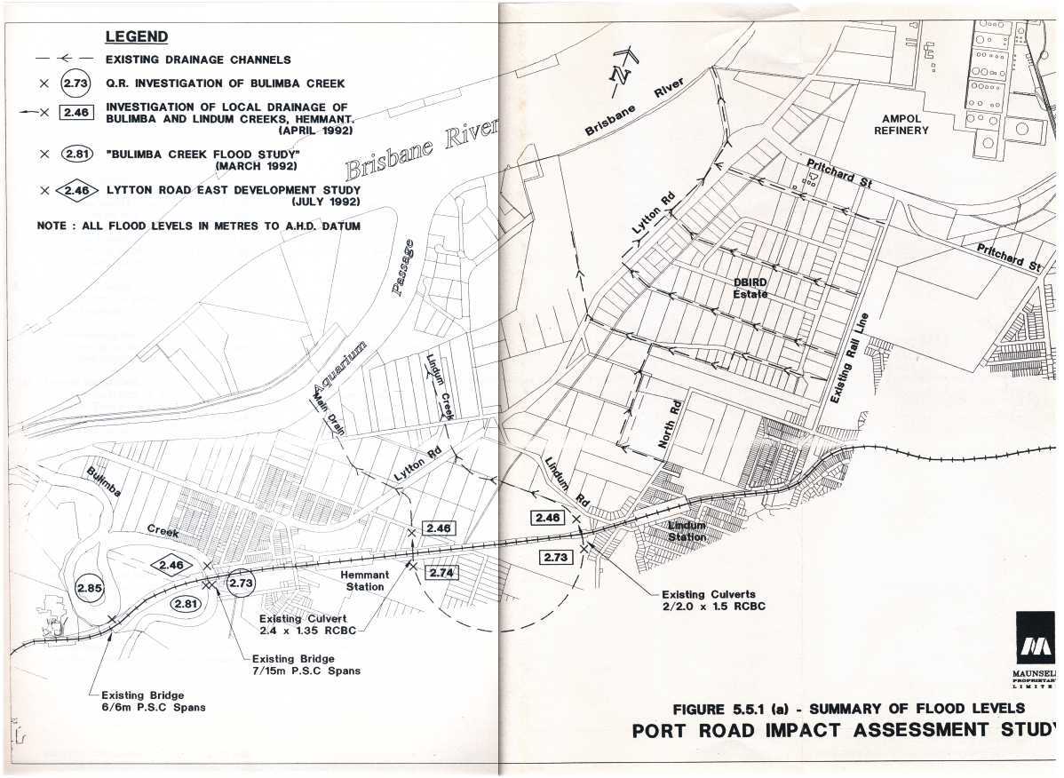
The Maunsell's EIS for the Port Road stated that the two sets of culverts beneath the rail line between Hemmant and Lindum Railway stations are NOW undersized. Of course, I have issues with anything Maunsell.
This restriction most probably took place as the Dual Gauge Rail Line to the Port of Brisbane was built.
The so called Public Consultation on the Port Road was not carried out on a present road corridor alignment. We as a community were not allowed to raise or discuss any other corridor along which the port road could follow. This strategy was also carried out by Maunsell previously during the Dual Gauge rail line, because when an executive of another well respected community group wanted to discuss alternatives he was told if he wanted to talk about alternate rail corridors he was most welcome to do so outside the meeting room but not in the meeting.
The above map is the Port Road the community was "consulted" on and no other corridor was allowed to be discussed by Maunsell and Queensland Transport..
This is the Port Road alignment we the community were not allowed to discuss at any meeting by Maunsell and Queensland Transport.
The Port Road corridor we were consulted by Maunsells and only allowed to speak about. No Alternatives allowed by Queensland Transport or Maunsells.
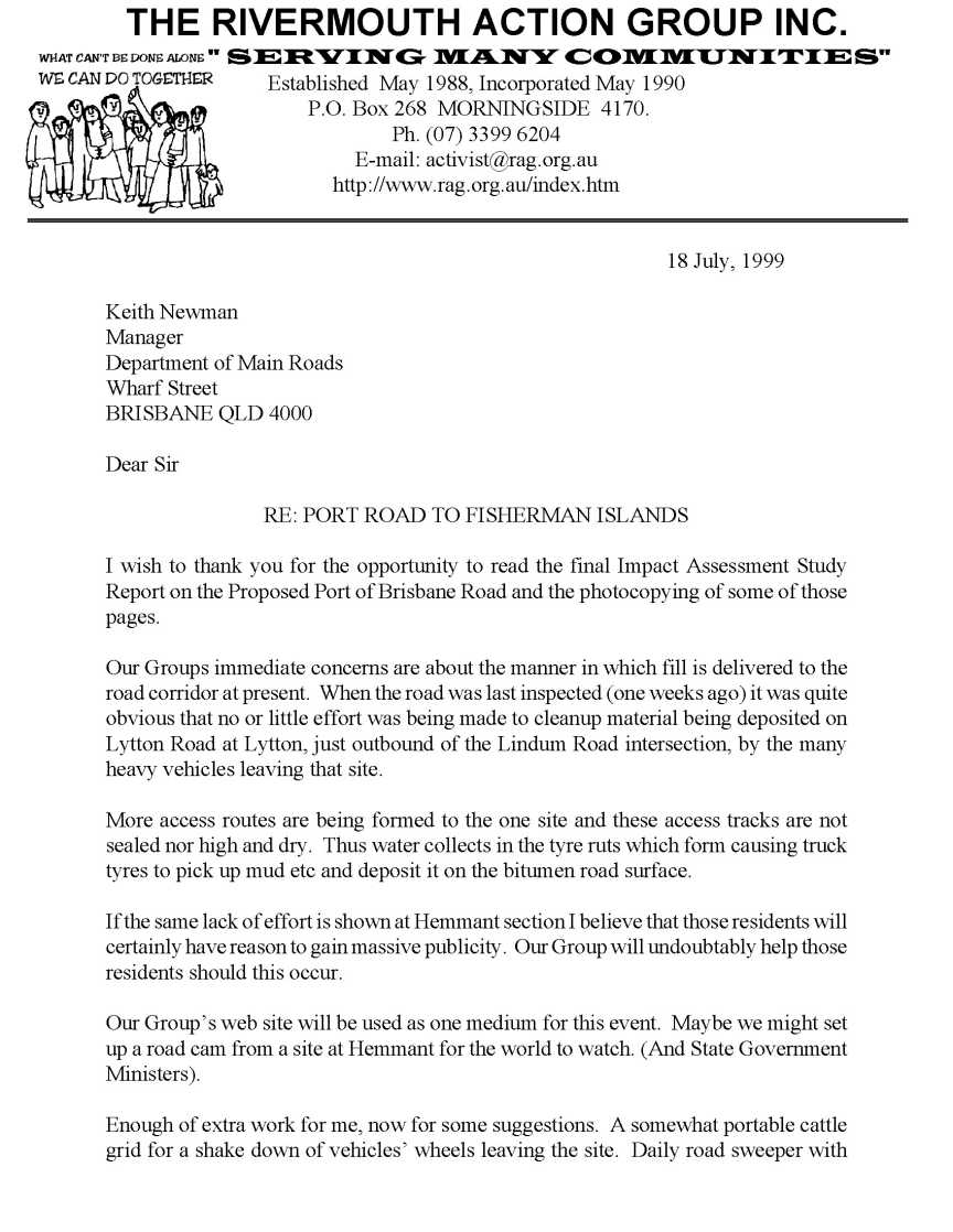
A copy of The Rivermouth Action Group Inc submission on the Port Road was printed in the Final EIS on the Port Road and a copy is available for reading below.
After my own birth in 1947, I was take home to Lindum Road, Lindum (now Lytton) where I lived with my parents until late 1969 when I married and moved out. My father moved to Lindum Road with his parents when he was 12 1/2 years old in 1930.
During the depression in the 1930's, the government undertook many community projects using men out of work for a couple of days a week which allowed unemployed men a small income to feed their families.
My father watched some of these workmen dig by hand, drainage channels in Lindum and Lytton to allow for the drainage of wetlands after rain periods. The local wetlands are below high tide level and as such the decision was made at that time to install tidal gates in these drains to restrict in inflow of salt water during daily tidal changes to protect pasture grasses for the many dairy farmers.
Upon reading a copy of the "125 years of Hemmant State School", I found an article about Albert Townsend on page 51 where he would receive 8 shillings and sixpence in ration tickets from the Wynnum Police Station for digging out drains at Lytton during the depression.
The natural drainage of this area had been changed with the building of the Brisbane River walls, the dredging of the Brisbane River, and the pumping of the dredge spoil behind the river walls, the building of new roads and Cleveland rail lines over the past 130 years ago.
My Grandfather Hubert A. Wilson was a foreman involved with the north bank river wall at Pinkenba and I have further photos in which he can be seen.
Looking at some of the photos I have you will wonder on which side of the wall is the Brisbane River.
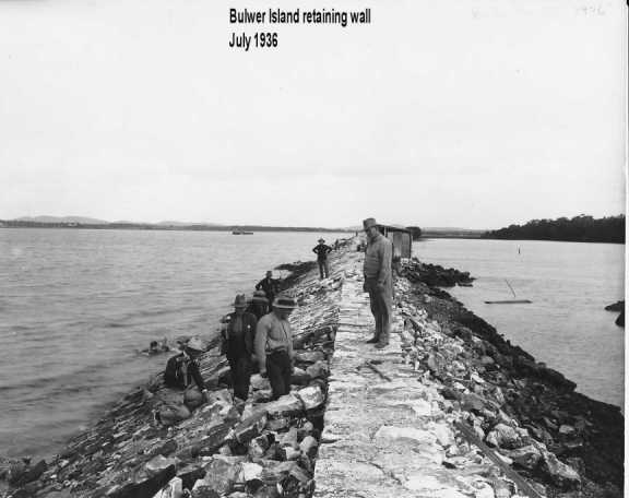
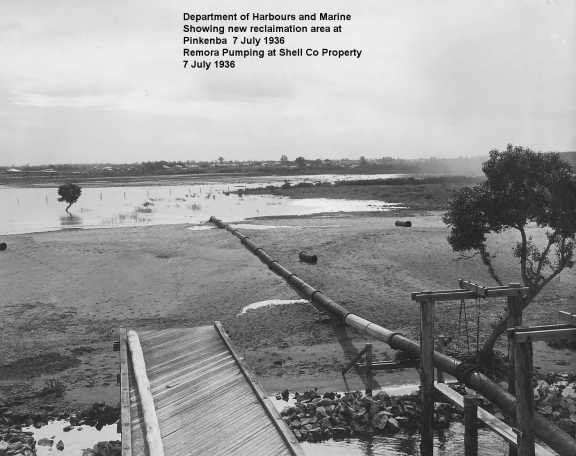
The landowners surrounding Lytton and Lindum utilised most of this low level lands for dairy farms. When I was younger there were six substantial dairy farms in this general area with three using the land between Lytton, Lindum and North Roads and a fourth in the same catchment.
With the decision to build the Ampol Refinery and move Brisbane's Port to Fisherman Islands the amount of heavy traffic which resulted, lowered the updated Lytton Road height more that a metre below its original built height.
With all of this knowledge and knowing one long term resident who had continued to request the government both state and local, carry out maintenance on the drainage channel for over 40 years, I made a submission to Port Connect in April 2011 asking for an on site meeting to explain to their engineer and hydrologist what I know of the flooding issues in the area and the restricted drainage channels which exist.
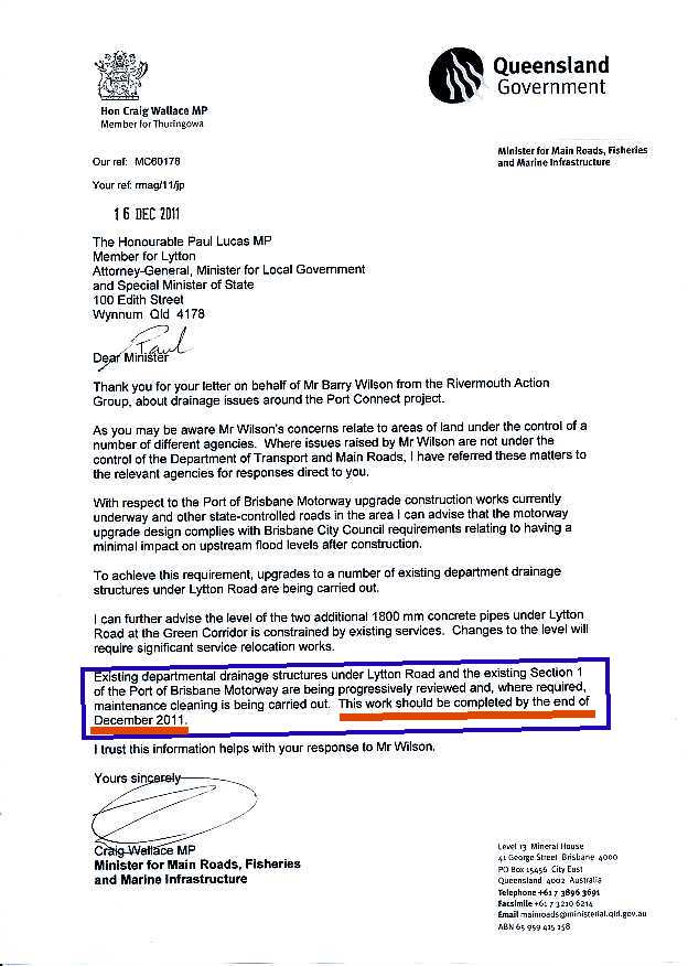
After four months I was told that there was no funds to undertake maintenance of the drainage channels and the new Motorway was not allowed to increase flood heights any more that 10 mm. compared with existing conditions. Copy available below.
Some of the photos on this page were taken late July 2011 the day of my 64 birthday and a few more on August 4 and even more since.
It is quite evident looking at them that no maintenance has been carried out on this drainage corridor for many (over 40 years) years yet correspondence suggests that it would be a annual inspection from Brisbane's Lord Mayor in 2002. (Letter below).
When the Lytton area north of Sandy Camp Road, Wynnum West was resumed by the Queensland Government for the development of the Port orientated industries a further large scale sand dredge pumping exercise took place.
Large quantities of solid fill were trucked into this area to fill the once extensive melaleuca wetlands and low intertidal wetlands and to raise the level of the remaining land to facilitate the industrial development we see at Lytton today. (Aerial photos 1946 to 2011 attached below)
The Department of Business, Industry and Regional Development were the department irresponsible for the loss of these vast wetlands, disturbance of acid sulphate soils .
The action of this filling resulted in large ponds of water being trapped within bounded areas waiting to be filled in either by dredge spoil or solid fill.
The area on the southern side of the Brisbane River just downstream of its connection with Bulimba Creek there once stood a large wooden wharf (visible in the 1946 and 1958 photos) and behind the wharf were large round concrete tanks (originally built during WW II by the US Army as a refuelling station for their fleet). Later after W.W.II the tanks were used to store whale oil for transhipping from the Tangalooma Whaling Station on Moreton Island. This whole area was reclaimed land from dredging the Brisbane River for navigation purposes. (visible in the 1946 and 1958 photos attached)
Further downstream is an area now known as Port West which was for many years known as Clunies Flats. This area as I remember as a young child was sandy covered in the declared weeds known as groundsel, prickly pear and a very thorny bushes called devil apples.
When I was about 15 to 17 years old this area was again used as a dredge spoil dumping area for both sand and mud /silt and then for many years after that time. The excess water which was pumped out of the dredge on to this area laden with very fine silt was then allowed to flow through large steel pipes about 30 cm through the bund wall into the drainage channel in the south east corner of this area.
What that caused was the fine silt which was still suspended in this outpouring then deposited into the drainage channel both up and down stream of the outlet with tidal flows.
Not only did it silt up the drainage channel downstream but silted up the culverts and up stream drainage channel as well thus reducing the drainage capabilities of the only remaining drainage corridor for the entrapped rain and flood waters held behind the raised Lytton Road.
See Natural Resources Ministers response
My concerns are that the about to be constructed Port Motorway extension will further increase the flooding in properties behind the Port Motorway due to the amount of fill required to build the four lane divided Port Motorway some 0.25 to 0.5 metres higher than the existing Lytton Road with the loss of flood plain capacity.
The Design Engineer from Maunsell who did design work for the Port Motorway in the mid 1990's admitted to a resident that he had not once visited the area until after he had finished his work but had carried out his investigation and planning from his office desk with photographic maps and plans of the area.
At one point in time an off ramp design would have required the filling in of a large section of freshwater wetlands owned by the Caltex Refinery. When this was pointed out to Maunsell we were told that it did not appear to be wetlands in the photographic maps. The Brisbane City Council has since declared this same area as a conservation wetland for protection into the future.
Let us not forget this is the same company (Maunsell) who under estimated the number of motorist who would be using the Clem 7 tunnel on completion.
Unless this drainage issue is resolved now, future generation will be burdened with unnecessary increased flooding both in levels and duration.
One of original the drainage corridors under Lytton Road has been filled in and now the new Port Motorway will remove any obvious existence except the UBD street directory show it as a creek in their road map for the area. It seems strange that engineers decided to remove and not reinstate this culvert given it is marked in the street directory. Map below.
What they have said is that this culvert allowed the water to drain the land on the river side of the old Lytton Road into the wetland on the eastern side of Lytton Road. That may have been so but it also allowed flood waters to flow in the opposite direction during flood times due to the actions of land owners which had their own drainage channels in place at that time.
What we have experienced over the years in Lytton and Lindum is work undertaken by Desk Top Studies.
In Queensland there two golden rules for Desk Top Studies.
1. Must be done at Night.
2 The light must be turned OFF.
Photo Maps of the Lytton Area 1946 to 2011
This page is maintained by
The Rivermouth Action Group Inc
as a community service.